Melbourne
16.1.2 Groundwater discharge into sea
Supporting information
The volume recognised in the water accounting statements (24,018 ML) represents the total volume of water discharged from groundwater into the sea in 2009–10.
The total volume of water discharged from groundwater into the sea includes regional flow (through flow) from the watertable and confined aquifers that leave the Melbourne water reporting region.
Quantification approach
Data source
Victorian Department of Sustainability and Environment: bore locations and groundwater levels data within Port Phillip and Western Port catchment management authorities; hydraulic conductivity and aquifer thickness from the Port Phillip and Western Port ecoMarkets groundwater model (GHD 2010).
Data provider
Bureau of Meteorology.
Method
Groundwater flow was calculated using a simple geographic information system (GIS) approach based on Darcy’s law. Groundwater levels were interpolated for each season using the ArcGIS Topo to Raster tool from reduced groundwater levels measured at monitoring bores. Seasonal groundwater flow grids were derived from groundwater level grids, aquifer thickness and hydraulic conductivity using a modification of the ArcGIS Darcy Velocity tool. Groundwater flow across selected flow boundaries (see the figure below) was then calculated using a simple GIS analysis and seasonal values were aggregated to reporting year. An in-depth explanation can be found in ‘Region notes’ under ‘Groundwater’.
Uncertainty
Uncertainty is ungraded.
- The uncertainty in the field measured data (e.g. groundwater levels, hydraulic conductivity) was unspecified and unknown; hence the impacts of such uncertainty on the groundwater flow was not estimated.
- The regional flow estimations were based on the interpolated groundwater level grids produced using ArcGIS Topo to Raster tool. Use of different interpolation methods may impact the values of the groundwater level grids and hence the estimated regional flow.
- Groundwater flow was estimated for a simplified boundary constructed from a series of line segments. Groundwater flow across this boundary was calculated using the method described above. The uncertainty surrounding this simplification was not analysed.
Approximations, assumptions, caveats/limitations
- Groundwater levels were estimated by assuming that all the hydrogeological layers within the Port Phillip and Western Port groundwater model region are hydraulically interconnected. This assumption facilitated the interpolation of a groundwater potential surface from groundwater level measurements, as these measurements were limited in number. Groundwater levels were also assumed equal to 0 metres Australian Height Datum (mAHD) at the coastline. These assumptions were used to generate seasonal groundwater level surfaces across the sedimentary area.
- Bore locations and the through-flow boundaries considered in the estimations were indicated in the figure below. Flow across the remaining boundaries was assumed negligible on an annual basis because aquifer properties like hydraulic conductivity limit flow (e.g. fractured rock basement), groundwater flow was approximately parallel to the boundary, or limitations of the method used in this estimation did not allow its application (e.g. Nepean Peninsula).
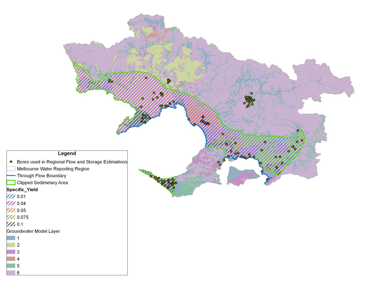
Map of hydrogeology in the Melbourne region showing the extent of the sedimentary area used for the estimation of storage and recharge, and the location of boundary reaches for which groundwater through-flow was calculated.