


This document describes the flood risk and previous flooding in the Myall Creek catchment.
Last updated:
July 2026.
Flood Risk
The Myall Creek catchment to Dalby drains an area of approximately 1375 square kilometres, extending from the Great Dividing Range east of Oakey towards the town of Dalby and the Condamine River. The main branch of the creek rises beneath Mt Mocatta, which is located north of Maclagan, whilst Cain Creek/Spring Creek tributary of the main branch extends eastwards towards Haden. The north branch of Myall Creek rises beneath Mt Mowbullan in the Bunya Mountains. Myall Creek joins the Condamine River just downstream of Loudoun Bridge on the Moonie Highway. The town of Dalby lies in the floodplain of Myall Creek, both the town and the surrounding agricultural community suffer extensive damage during major floods.
Previous Flooding
Myall Creek has records of floods dating back to 1908 with 11 major flood events having occurred since this time, the highest being the February 1981 flood which rose to a height of 4.50m on the flood gauge located in Patrick Street. This resulted in some 700 homes and 140 businesses being inundated by floodwaters and some 25,000 ha of agricultural lands suffering moderate to severe flood damage.
Four large floods were recorded through Dalby during December 2010 and January 2011. The largest flood (3.74 metres) was the 5th highest on record dating back to 1942. More recently, four floods in 5 months occurred during the period from Spring 2021 to Autumn 2022, culminating in a major flood peak of 3.6m on the 29th of March 2022, damaging several properties and numerous roads in the region.
Previous flooding events
| Flood Event | Dalby |
| March 1908 | 4.15 |
| February 1981 | 4.50 |
| June 1983 | 3.80 |
| January 2011 | 3.74 |
| December 2021 | 2.75 |
| March 2022 | 3.60 |
All heights are in metres on flood gauges.
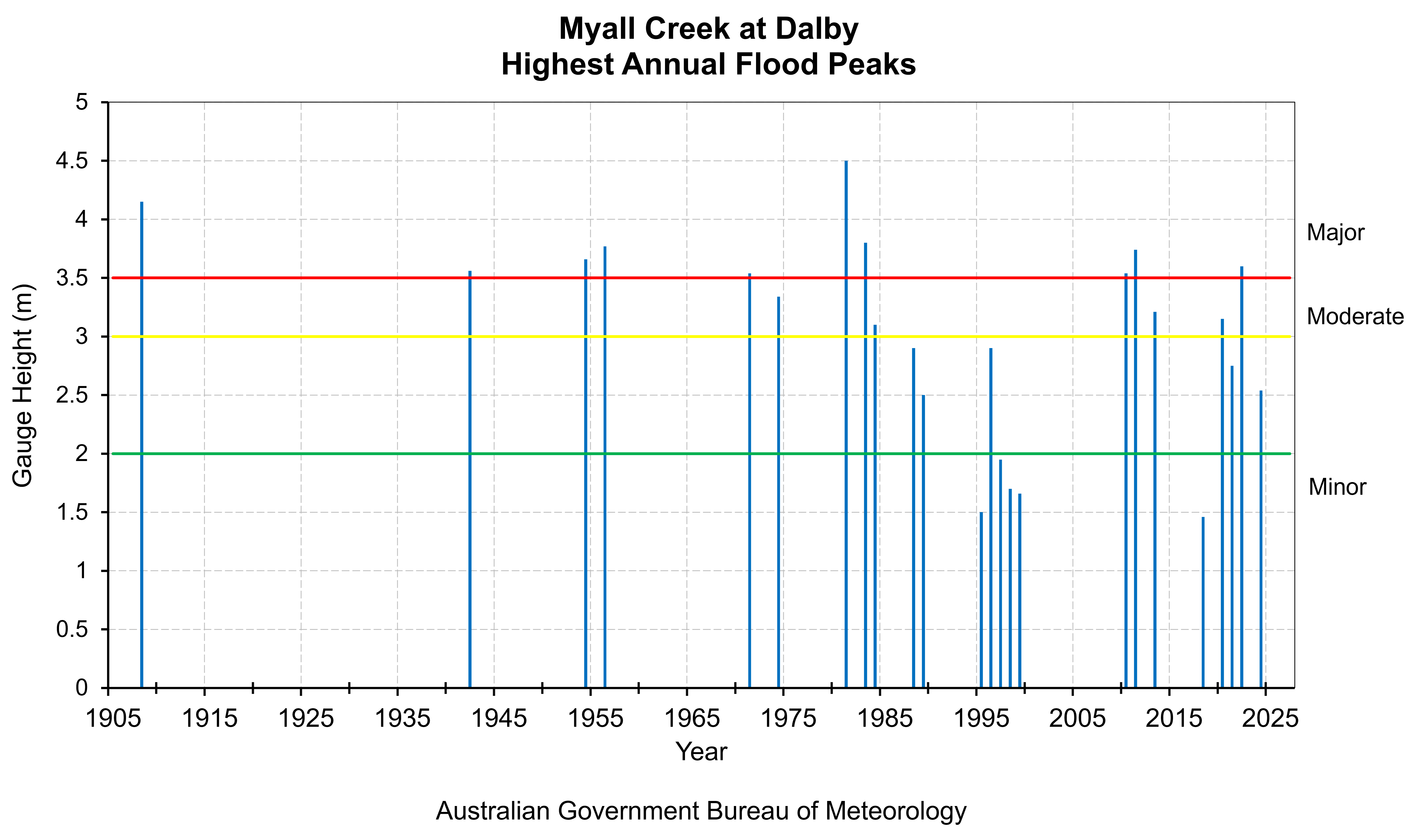
This chart shows flood level classifications of recorded flood gauge height observations of Myall Creek at Dalby.
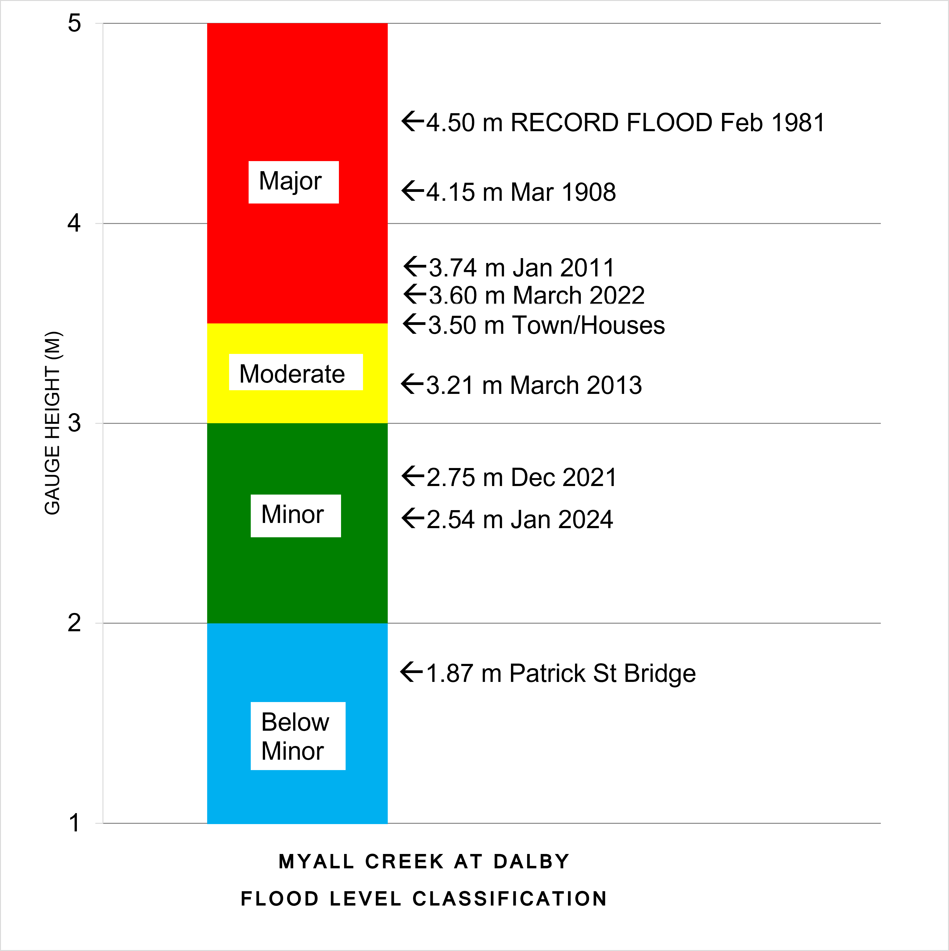
The totem pole shows flood level classification and associated impacts related to local reference sites, along with recorded flood gauge height observations of notable flood events that have occurred on Myall Creek at Dalby.
Further Information:
- Latest rainfall and river heights
- Flood warning service for the Myall Creek: Queensland Service Level Specification
- Catchment map: Queensland Upper Condamine map
- National Arrangements for Flood Forecasting and Warning