Summary
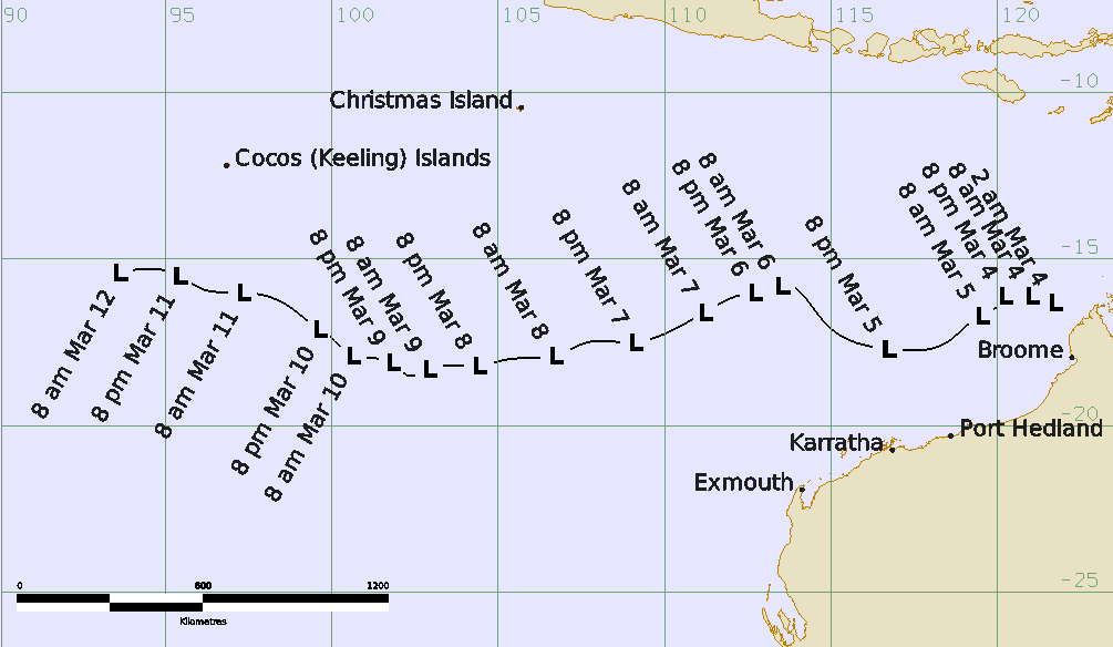
A weak tropical low, 30U, formed offshore from the west Kimberley coast on 4 March 2026, about 200 km north-northwest of Broome. The system then moved generally westwards, over open waters in the Indian Ocean under the influence of a mid-level high pressure ridge to the south.
Despite environmental conditions being generally unfavourable, the system was able to strengthen, with gales developing in the western quadrants on 6 March. These gales soon became mostly confined to the northwest quadrant, where they persisted until 8 March. As gales did not wrap more than halfway around the system centre at any stage, 30U did not reach tropical cyclone status.
On 5 and 6 March, 30U interacted with another tropical low, 28U, to the northeast. As a result, Fujiwhara effects were observed as both systems tracked around a common mid-point. The speed of motion of 30U increased and it started moving towards the northwest. As 28U weakened, the Fujiwhara dance between the two systems came to a close, and 30U resumed its westward trek from the afternoon of 6 March.
After weakening on 8 March, the remnant circulation of 30U tracked towards the west to northwest, before dissipating during 12 March.
Due to its offshore development and generally westwards movement, there were no direct impacts from 30U to any mainland or island communities.
Track and Intensity