


Severe Tropical Cyclone Thelma, 6-12 December, 1998
[Thelma main page]
[Track of Thelma]
[Images of Thelma]
[Radar images of Thelma]
[Damage from Thelma]
Radar images of Tropical Cyclone 'Thelma'
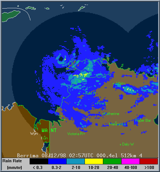
This is a composite image taken from Bureau radars located in Darwin, Gove (near Nhulunbuy), and Tindal (near Katherine). At this stage, the cyclone was beginning to move away from the Tiwi Islands and the Northern Territory coast. The eye of the cyclone is clearly visible in the northwest quarter of the images, as is heavy rainfall over Darwin on the northwest mainland coast as one of the outer bands of the cyclone moved over. Rain rates further away from Darwin are attenuated (weakened) on the radar display because of the heavy rain near the Darwin radar.
Find out about World Wide Web access to the Bureau's radar network
[Thelma main page]
[Track of Thelma]
[Images of Thelma]
[Radar images of Thelma]
[Damage from Thelma]