
More local flood information now online
People in the Lismore region can now access data from two new local flood monitoring sites on the bureau's website for the first time. The new sites provide situational awareness and take the total number of rainfall and water level gauges in the Wilson River catchment to 31.
By acquiring the Ballina Street Bridge and Rocky Creek Dam monitoring sites the Flood Warning Infrastructure Network (FWIN) program has made valuable local flood information more accessible to communities, emergency services and decision-makers.
In consultation with Lismore City Council, data from both sites is now available online, giving residents easier access to information about local conditions and helping build a more complete picture of flooding across the Northern Rivers.
The FWIN Program makes critical flood data easier to access, use and maintain over the long term. By acquiring locally operated flood sites and bringing them into a nationally supported network, FWIN helps ensure communities have access to trusted information when severe weather threatens.
For communities continuing to recover from the devastating 2022 floods, access to reliable local information remains important. Making this data publicly available provides another valuable source of information to help residents stay informed, make decisions and better understand changing conditions during severe weather.
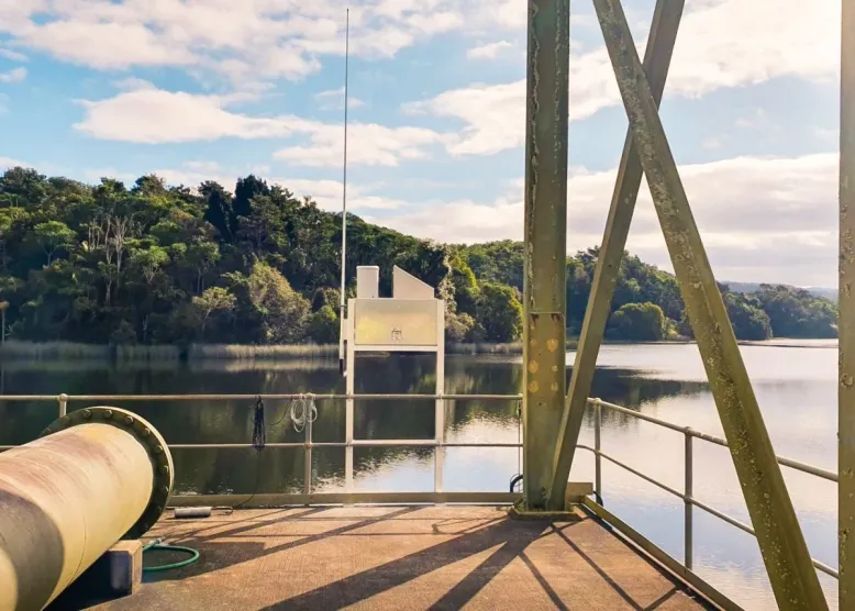
The Rocky Creek Dam gauge was installed in 2025
Investing in the future
Lismore City Council funded and installed the two new flood gauges in 2025 to enhance real-time flood-data collection and emergency response across the region.
After acquiring the two sites, the bureau worked to make the data available in its systems and on the website. The collaboration demonstrates how local investment and national programs can work together to deliver greater community benefit.
FWIN Program Acting General Manager, Kim Daniels, said improving access to local flood information is a key focus of the program.
"Access to reliable information is an important part of preparing for severe weather. One of the key benefits of the FWIN Program is making valuable local flood data more accessible to the communities that need it.
"By bringing these sites into the bureau's network and making the data publicly available, we're helping residents, emergency services and local organisations access more information about local conditions.
"The acquisition of the Ballina Street Bridge and Rocky Creek Dam sites will also help ensure they remain reliable and available into the future," she said.
Lismore City Council Mayor Steve Krieg said access to local information would help emergency services and the community prepare and stay informed during flood events.
"Every flood behaves differently, so having readings from more locations gives us a more detailed picture of changing conditions and supports informed decisions when it matters most.
"Making this information available on the bureau’s website also gives residents an easier way to monitor local water levels, alongside official forecasts and warnings.
"It’s great to see Council’s investment in these gauges delivering wider benefits for our community, with the bureau’s ownership supporting ongoing maintenance and reliability," he said.
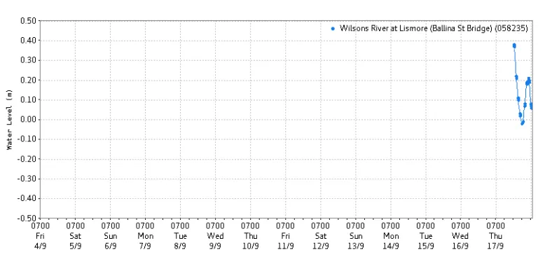
Data from two sites is now showing on the bureau's website
Supporting flood-prone communities
Lismore experienced some of the worst flooding in its history in 2022. The event had a major impact on homes, businesses and essential services across the region.
Since then, improving flood resilience and ensuring communities have access to the information they need before, during and after flood events has remained a priority.
Making the data available online from the Ballina Street Bridge and Rocky Creek Dam sites gives locals another source of information. To view the information for these sites, visit www.bom.gov.au/weather-and-climate/specialised-forecasts-and-observations/rainfall-and-river-conditions. Select Rainfall and river conditions > New South Wales. In Other links, select Rain & river data > Latest river height data - Tweed, Brunswick, Richmond Wilsons, Clarence.
While the sites are not currently part of the bureau's formal flood forecasting service, the information they provide can help build a clearer picture of local conditions during periods of heavy rain and flooding.
Remediation works are planned for late 2026 to further improve the sites and support their ongoing performance.
The FWIN Program continues to work with councils and local partners across Australia to strengthen flood warning infrastructure and improve data accessibility and ensure more communities can access the information they need to prepare for and respond to flooding.