
Where to find alpine weather information
Do you live in an alpine region or are heading off on a trip to the snow? It is now easier to view and monitor conditions via the Bureau's Alpine regions page. This page brings snowfall, temperature and wind forecasts all together in one place.
You can also view weather conditions for snow resorts, towns, and remote areas along the ranges of south-eastern New South Wales, north-eastern Victoria and the Central Plateau of Tasmania.
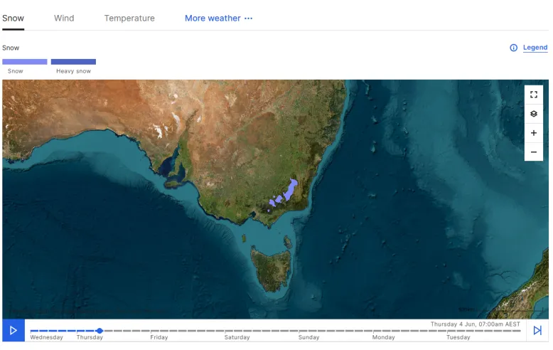
Snow forecast on the Alpine regions page
How snow forms
Snow forms high in the atmosphere where it is very cold, when water vapour turns directly into ice crystals.
If these ice crystals grow, they can become so big and heavy that they fall as snowflakes.
Snow can fall at any time of year under the right atmospheric conditions. For more information, watch our Understanding snow video on YouTube.
In Australia, the main weather systems that bring snow are cold fronts, and/or low pressure systems.
These systems originate well to the south of Australia and draw in cold Antarctic air.
How snow is forecast
As a weather system develops and moves closer to Australia our snow forecast confidence and detail will increase.
Our meteorologists will monitor the system, looking for cold air and moisture to align. If these atmospheric conditions look favourable for snowfall, we will issue it in our 7-day forecasts.
The Bureau does not forecast exact amounts of snowfall, instead we forecast the chance of snow falling at a certain height above sea level.
This is also known as the snow level – the altitude above which precipitation falls as snow instead of rain.
Cooler temperatures lower the snow level, while warmer temperatures lift it.
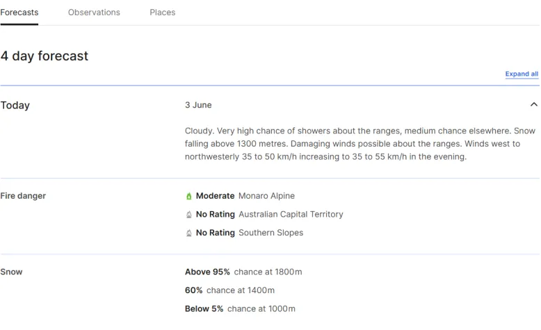
Forecast for the Snowy Mountains forecast district in New South Wales
Where you can see snow
If your location is situated at an elevation that is above the snow level when snow is on the forecast, then you may see snow.
Snowfall to lower elevations is most common at night or during the early hours of the morning – the coldest time of day.
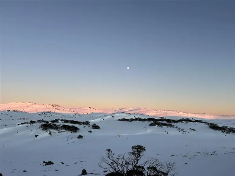
Kosciuszko National Park, New South Wales. Credit: Casey McCarthy.
Forecasting the snow season ahead
The Australian snow season is highly variable and complex.
The area, depth and duration of snow cover can vary from year to year, largely driven by synoptic and atmospheric variability (such as individual cold fronts and cut-off lows).
A single, well-timed, weather event can have a big impact on the amount of snowfall and length of the snow season.
Generally, years with more frequent snowfall occur when there is above average precipitation and below average temperatures.
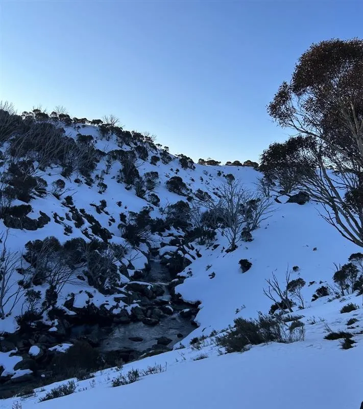
Kosciuszko National Park, New South Wales. Credit: Casey McCarthy.
Some climate factors may increase the chances of snow over a longer-term period, such as a negative phase of the Southern Annular Mode, which typically brings low-pressure systems and cold fronts further north into southern Australia.
El Niño years tend to have lower peak snow depths in Australia's alpine region. However, El Niño does not necessarily result in a poor snow season as cooler night-time temperatures and reduced rainfall – conditions that can occur during an El Niño event – can often mean that the snow that does fall is retained on the ground.
These factors may tilt the odds towards a particular outcome rather than guaranteeing it.