Summary
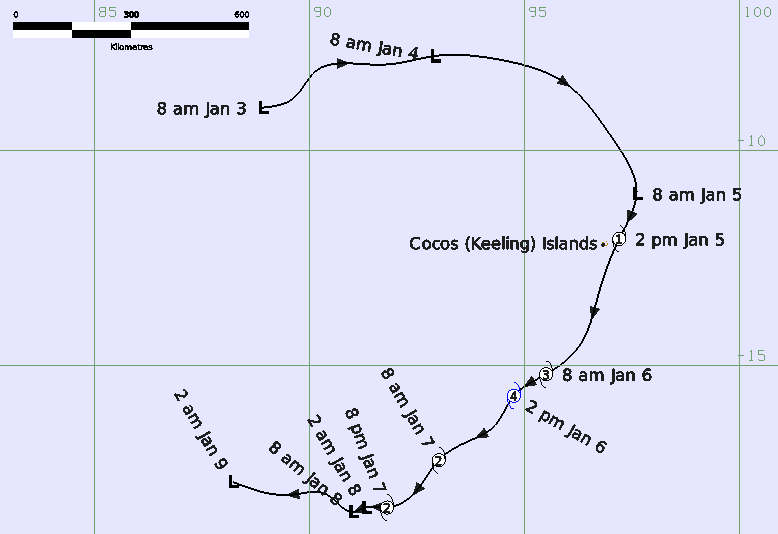
Severe Tropical Cyclone Jenna was another small but intense system in the Indian Ocean that passed just to east of Cocos (Keeling) Islands bringing a period of strong winds and heavy rainfall to the islands.
As Jenna moved away from the Cocos (Keeling) Islands it rapidly intensified in a favourable environment and reached a maximum 10- minute mean wind speed of 90 kn (165 km/h) between 0600-1200 UTC 6 January (1400- 2000 AWST 6 January where AWST=UTC+8 hours). Dry air and shear caused the system to weaken rapidly, and Jenna decreased below tropical cyclone strength at 1800 UTC 7 January. The circulation then moved west out of the Australian region on 9 January and dissipated over the central Indian Ocean on 11 January.
Cocos Island AWS recorded a maximum wind gust of 49 kn (91 km/h) and the Cocos Island National Tidal Centre AWS recorded a maximum wind gust of 51 kn (94 km/h) during 5 January as Jenna passed very close to the islands. There was 70.2 mm of rain recorded to 9 am CCT 6 January.
For more information see the TC Jenna Final Report (doc).
Track and Intensity Times in AWST (AWST=UTC+8h, CCT=AWST-1.5h)