
Responding to community feedback
The latest round of website updates are now live. This release delivers user experience improvements addressing community feedback around radar presentation and ease of access to familiar radar views.
You'll see radar image improvements, new quick links to radar views, and range rings to help you locate yourself or your property in relation to radars.
Today's update follows the 29 July website update when we refined the logic that decides which station serves weather data for your location.
Website update 16 Sep 2026: New rain radar and weather map tools
So let's dive in. Take a look and see what's changed.
From the home page of the bureau website, you can see the rain radar by selecting rain radar and weather maps on the top right.
And here in the radar view, there's now a new button.
Radars here in the upper right, where you can select which radar you'd like to see information from.
By default, our capital cities are listed here, but you can go into any of the state and territory pages and find regional radars as well.
For today, let's go into New South Wales and select Newcastle.
And here you might notice a few changes.
The map is zoomed and centred on the radar you've selected.
The zoom level is approximately the same as the 128km zoom which was available on our old website.
Also in the radar viewer, there's a radar card in the top left telling you which radar you're looking at and a symbol right on the radar's location.
We have added these dynamic range rings, and these rings will scale up or scale down as you zoom in and out on the map.
Range rings are these circles around the radars location alongside distances on the horizontal line.
That's there to act as a guide and help you judge how far away the rainfall is from known landmarks and locations.
There have been some data processing improvements to the rainfall, so it should look a little better in situations where the rain is very light or where you're seeing information from overlapping radar sites.
Once you've selected a radar to put on the map and you go back to the top here, you will now have a unique link in your URL right at the top, which you can save and bookmark or even share.
Every time you follow that link, the radar page will open with the radar exactly as you like it.
If you don't want these settings on your map, that's fine too, they can be toggled off.
To do so, you go into the settings on the upper right and you toggle off radar sites, much like you can with radar coverage.
I hope you enjoy using the new radar tools and if you do run into any trouble, you can always visit the website help page for tips and troubleshooting advice.
Rain radar and weather map: rain rate and rain reflectivity images
We've made changes to improve how how rain is displayed on the weather map. Processing improvements mean that the rain rate (mm/h) and rain reflectivity (dBZ) past rainfall layers better detect and more accurately display rain.
You'll notice higher definition and detail for:
- very light to moderate past rainfall
- rain in areas covered by overlapping radars.
Easier access to radars
There are 2 new ways to quickly get to your preferred radar view:
- radar quick links, or buttons, on the map
- 'Radar sites' map setting.
From the Rain radar and weather map select the 'Radars' button to choose your preferred radar.
Once selected, the map will zoom in and centre on that radar. The map will also remember your most recent radar selection on your next visit.
If you have a customised location home page, you won't see the radar quick links there. Learn more about managing favourite locations and customising your homepage.
Radar sites on the weather map
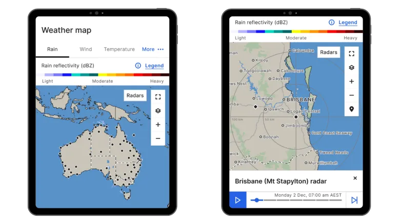
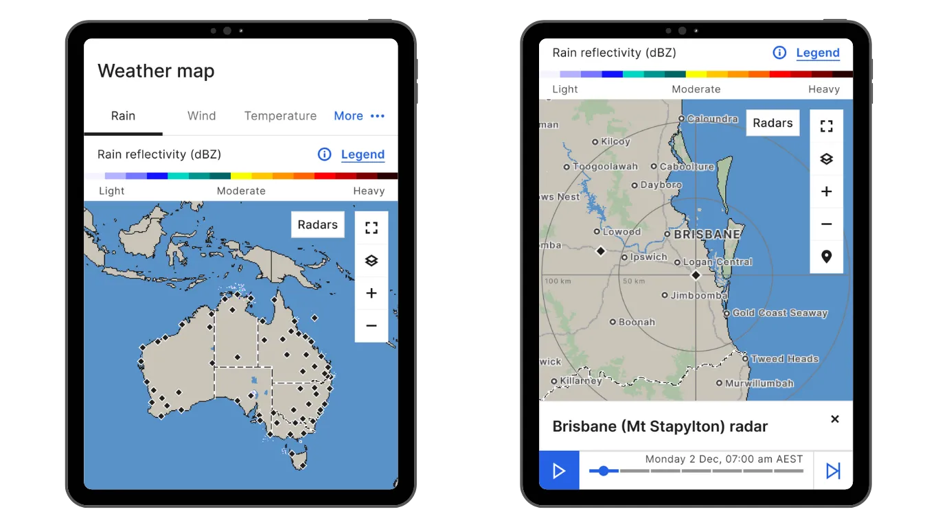
In Rain radar and weather map settings, you can now choose to display radar location icons and range rings on your weather map. These new tools help you get to your local radar images faster and confidently judge how close observed rain is to your location.
To see radar sites and range rings on your weather map, navigate to the page where you usually view radar images:
- Rain radar and weather maps
- Forecasts and observations map
- Location page – town, city, district, state or territory.
Select More weather to choose radar information to display on your map. When the 'Radar sites' layer is on you will see:
- a diamond-shaped icon at each radar site on the weather map
- radar names when you hover over a radar icon
- radar range rings when you select a radar.
Select a radar icon and the map will zoom in and centre on that radar. The weather map remembers your most recent map view on your next visit. If your map settings are not saving, you may need to change your browser's site data or cookie settings.
Radar bookmarks
New radar-specific links (URLs) mean you can now save, share and bookmark your favourite radar views.
The unique URL for each radar will take you directly to the weather map zoomed in and centred to that radar. To find a radar URL, click on a radar site icon or a radar quick link. You can copy the URL from the address field of your web browser.
For example, the URL for Brisbane's Marburg radar is bom.gov.au/weather-and-climate/rain-radar-and-weather-maps?radar=50-brisbane-(marburg).
Coming soon
We have more updates planned for 2026:
- more weather map refinements; including more roads and Aboriginal language place names
- 7 day tropical cyclone forecast; bringing all our current tropical cyclone activity and forecasts together in the new website.
Thank you for your feedback. Please keep telling us what you like, and what website improvements you're keen to see.