
What is the impact of floods?
Floods can cause enormous damage very quickly anywhere in Australia. Many Australian communities experience trauma and loss through floods.
Even minor flooding can be dangerous.
Knowing about different types of floods and how they may impact you will help you prepare.
What are the main types of floods?
There are 3 main types of flooding – flash, riverine and coastal.
What is flash flooding?
Heavy or intense rainfall can quickly lead to flash flooding. It can impact all areas with sudden water gushes and flooded roads.
Flash flooding can happen along rivers and creeks. It can also occur when heavy rain fills drains faster than they can carry water away, especially in cities and towns.
What is riverine flooding?
Riverine flooding happens when river levels rise so that water covers the surrounding land. This is mostly caused by heavy or prolonged rainfall.
High tides and storm surges can slow or stop rivers from flowing into the sea. This can make river levels rise closer to the coast.
In Australia's tropical north, rivers and creeks can rise quickly during the wet season, sometimes without warning.
Given many Australian rivers are long, riverine floods can happen weeks or months after rain, sometimes hundreds of kilometres away. For example, floodwater in the upper Murray River – Australia's longest at more than 2,500 km – may take months to reach the river mouth in South Australia.
In inland parts of Queensland, New South Wales and Western Australia, riverine flooding can affect thousands of square kilometres for weeks or even months at a time.
What is coastal flooding?
Coastal flooding can happen when sea levels are higher than usual. This can occur during very high tides, tsunamis, tropical cyclones, low-pressure systems or severe weather that creates large waves.
What causes floods?
Heavy rainfall
The most common cause of flooding is heavy rainfall. Heavy rainfall can be caused by thunderstorms, low pressure systems, tropical cyclones or other weather systems. Flash flooding can happen shortly after heavy rainfall, often from severe thunderstorms.
High tides
High tides are a natural and predictable part of the tidal cycle. Exceptionally high tides can increase the risk of coastal flooding and worsen the impacts of riverine flooding.
Learn more on our Tides and sea level page.
Storm tides and storm surge
Coastal inundation (flooding) can occur during a storm surge, when strong winds and low pressure cause the sea level to rise or surge above normal tide levels.
Large storm surges can occur when tropical cyclones or large storms approach land. Less extreme surges can occur when storms are far out at sea.
The combined effect of high tide, storm surge and waves is sometimes called a storm tide. If a storm tide coincides with a riverine flood, the area and extent of flooding can increase.
Learn more about storm surge and storm tides on our Tides and sea level page.
Tsunami
While rare, land flooding in Australia is still possible from tsunami. This series of long ocean waves can travel a long way after a landslip event, such as an earthquake.
Low-lying coastal areas may be flooded. Even during a small tsunami, seawater can flow onto the foreshore and create dangerous currents.
Learn more about tsunami.
Snowmelt
When temperatures rise quickly or heavy rainfall occurs, snow can melt rapidly. This can send more water into rivers and streams, which may make flooding worse.
Dam releases
Dams can hold vast amounts of water, but all dams have a capacity. An uncontrolled dam will spill over when it reaches capacity. Some dam operators may release water as a controlled release. Sometimes, the outflow from dams can contribute to flooding.
We work closely with dam operators to ensure they have the latest forecast and warning information. Operators use this information to manage water storages and help minimise impacts on downstream communities.
Learn how we support communities, governments and industry to understand and manage water resources, on our Water sector page.
Other flood impacts
Floodwaters can spill onto massive areas known as floodplains. Floodwater carries fine sediment, with valuable nutrients and minerals, turning floodplains and river areas into rich, fertile lands.
Some floods may also have positive impact where they:
- fill billabongs and wetlands and replenish water bodies, like creeks, lakes and dams
- contribute to the life cycle of plants and animals, including in marine environments
- support agriculture – for example, bananas in Carnarvon, Western Australia; cotton in St George, Queensland; rice in Griffith, New South Wales; and stone fruit in Swan Hill, Victoria.
The Queensland floods in 2019 are a dramatic example of how floods can both destroy and renew. Lives and homes were lost and much of the state's cattle industry wiped out, with devastating impacts. As flood levels subsided and water drained to the south-west, the water also brought life and economic benefits to drought-affected areas.
Video: Queensland floods: the water journey to Kati Thanda–Lake Eyre
A second rain system in late March brought even more water, extending across vast flood plains and eventually flowing into Kati Thanda-Lake Eyre, many weeks after the rain first fell. So the water we see down below us has travelled maybe 1000 kilometres. Sometimes at a slow walk, sometimes perhaps at a slow jog depending on how narrow the channels are.
And a massive lake surrounded by tens of thousands of kilometres of desert. Just a big area of water in the middle of Australia. So it’s a huge basin that all this water is draining into. About 17% of the total size of Australia, the water is just draining down into this lowest part of the continent. It's just gone bang and it's growing like crazy.
We've increased our employment, we've increased the number of aircraft, and what we're seeing is a 600-fold increase in the number of four-wheel drives coming through, and actually experiencing Lake Eyre on their way up to the rock.
Beautiful, absolutely stunning. It's amazing, how big it is. You can just see forever. It's also the Simpson Desert and the lake just right next to each other, is pretty amazing.
So this is fantastic news for the graziers, for the wildlife and even for the river itself, for the fish and the bird life that rely on that flow.
We were looking at destocking, starting to destock, and we just sort of started, when that rain fell up north. And as bad as it was, it was good for us, you know.
Every flood is different hey, and that’s what them old fellas said when I first come into this country, 'every flood is different'. How it flows, where they spread out you know, how much feed they grow. And takes a fair while to get down here, like it's only walking pace. You've got to wait for it to come, you've got to wait for it to rise, you've got to wait for it to drop, you've got to wait for the feed to grow. So it is a fair waiting game. Like floods do us good, more than bad, you know?
This is the Warburton River. You can see the way it tracks in a very snake like fashion, though the desert county. Very dry everywhere else, but the Warburton still has water in it. The Warburton River is one of the rivers which goes into Lake Eyre, not always water in the Warburton River, but certainly brings life back to this region when the water does flow. So you can see there's trees, and right at the moment there's bird life, pelicans, and certainly fish in the river at the moment as well. Quite deep here, you can see how the river has carved out channels in the desert country basically. So you look to the horizon, and there is nothing as far as the eye can see except some small shrubs, bushes and dune country. With this oasis I guess of trees and life in the Warburton River.
The lake is incredible, having gone out there 100's of times, I think it's something all Australians should come out here and experience, it's like looking at an inland ocean.
In this year 2019, about 80% of northern Kati-Thanda filled. But that water should also last right though winter, and into spring. By the time we get into summer, there is probably not going to be a whole lot of water left.
Usually when we think about floods, we associate them with destruction and devastation. But for the Channel country, flooding brings life to the outback helping vegetation and wildlife flourish. We haven't seen this amount of water since 2011. With it comes a wave of tourists and an economic boost to towns and communities.
Huge downpours of rain brought devastating floods to parts of northern Queensland and the Northern Territory early in 2019. This water made a slow journey southwest, filling the Georgina, Diamantina and Warburton rivers and flooding desert towns.
A second rain system in late March brought more water, extending across vast flood plains and eventually flowing into Kati Thanda–Lake Eyre many weeks after it fell. So how did the water end up in Australia's largest lake?
January–February rain
In late January and early February, an intense and slow-moving monsoonal low over northern Queensland caused record-breaking rainfall and disastrous flooding. Areas affected included the Townsville region and westwards right across the state.
A phenomenal amount of rain fell. In the seven days to 4 February our rainfall gauge at Townsville Aero recorded 1,053 mm, and 1,257 mm in the 10 days to 6 February. There were several sites in elevated areas including Paluma, Woolshed, and Upper Bluewater that reported 12-day accumulations of more than 2,000 mm.
Further west, large areas recorded 300–500 mm including the northern parts of the Diamantina catchment. This is the water that made the long journey south.
Ex-tropical cyclone Trevor rain (March)
In March ex-tropical cyclone Trevor brought more rain, over a broad region of central and southwest Queensland and adjacent area of the Northern Territory. In the week to 30 March, widespread rainfall of 50 mm to more than 200 mm was recorded across parts of the Georgina/Eyre Creek, Diamantina and Thomson/Barcoo/Cooper catchments in the Northern Territory and Queensland. It caused significant flows in these rivers.
Where the water goes
Australia is divided into drainage divisions and river regions based on topography. Most of the drainage divisions affected by the January–February floods (such as around Townsville) drain to the sea, with the exception being the Lake Eyre Basin – the lowest natural point in the country.
Diamantina catchment
The vast Diamantina River catchment is in southwest Queensland and covers an area of about 119,000 sq km. The river passes through Birdsville before crossing the Queensland–South Australia border 10 km south of this town. From there the water moves into the Goyder Lagoon and flows into the Warburton River for the final 150 km to Kati Thanda–Lake Eyre. The distance the water covers is longer than that though, due to the winding of the river system.
By the end of February, floodwaters captured by the Diamantina had been steadily moving downstream into the north-east of South Australia with flooding across vast areas of flood plain. On 22 February the Diamantina River gauge at Birdsville peaked at 8.15 m, surpassing the peak river heights of significant floods in 1999, 2000 and 2009 – but falling short of the major 1974 flood where it peaked at 9.45 m.
By late March, the water had receded in the Diamantina between Birdsville and the Goyder Lagoon, and the vast flood plain was 'greening'.
However, there was more water to come. Rainfall from ex-tropical cyclone Trevor brought a 'second wave'. The water level at Birdsville measured 2.4 m on 18 April and rose steadily to peak at 7.7 m on 29 April.
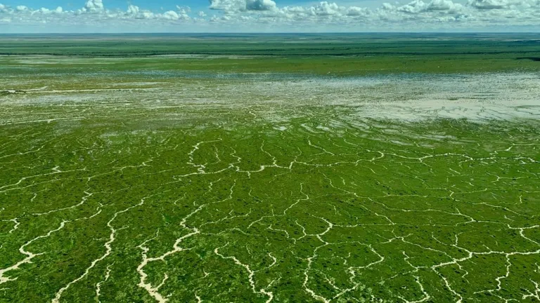
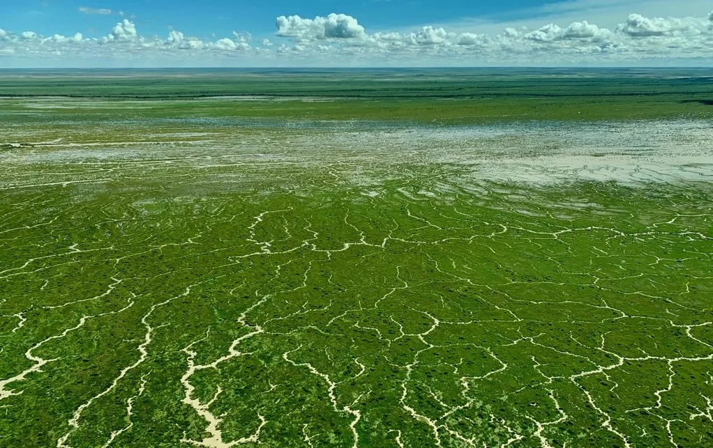
Goyder Lagoon in the Lake Eyre Basin, May 2019. Credit: Matt Harnetty.
Georgina River and Eyre Creek catchment
This catchment drains an area of more than 200,000 sq km. It rises to the northwest of Mt Isa with three main tributaries, the Buckley, James and Ranken rivers. Further inflow enters the system from creeks and rivers. The two main tributaries are the Burke and Hamilton rivers.
The Burke River drains the area to the north of Boulia and enters the Georgina River about 20 km upstream of Marion Downs. The Hamilton rises to the north-east of Boulia and enters the Georgina River below Marion Downs.
The final gauge for this river system is at Glengyle Station. From there it is more than 300 km (as the crow flies) to the Goyder Lagoon. The January–February rain resulted in water level at Glengyle reaching about 3.5 m in the latter part of February. However, water didn't progress far past Glengyle.
The rain from ex-tropical cyclone Trevor was much more significant here – the water level reaching 4.9 m early in March. The flow then tracked through the dry desert areas, finally reaching the Goyder Lagoon in early May.
Lake Eyre Basin
Floodwaters drained through the Goyder Lagoon, part of the Lake Eyre Basin. Water flows from the lagoon into the Warburton River on its way to Kati Thanda–Lake Eyre – one of the largest saltwater lakes in the world.
The Lake Eyre Basin region covers about 1.2 million sq km of arid and semi-arid central Australia. That's 17% of the continent – nearly 5 times the size of the UK. It stretches, north to south, from just below Mount Isa in Queensland to Marree in South Australia. From west to east, it extends from Alice Springs in the Northern Territory to Longreach and Blackall in central Queensland. This is the world’s largest internally draining system.
Also Australia's largest lake, Kati Thanda–Lake Eyre covers an area of about 9,500 sq km – however it's rare for the lake to completely fill. When the lake is full, it has the same salinity level as the sea, but as it dries up and the water evaporates, salinity increases.
Water from January–February rain
By 5 March, the Warburton River gauge at Poothapoota in South Australia – just downstream of the Goyder Lagoon – gave the first indication that the floodwaters were moving through, with the water level jumping 0.8 m in about 30 minutes and continuing to rise rapidly. It peaked at 5.7 m on 12 March. Water began flowing into Kati Thanda–Lake Eyre on 15 March.
Water from ex-tropical cyclone Trevor rain (March)
Water from the Diamantina River moved through the Goyder Lagoon while water from Eyre Creek also contributed to flow downstream of the lagoon. The water level at Poothapoota downstream of the Goyder Lagoon peaked at 5.4 m on 20 May.
How full was the lake?
In early July satellite images showed about 80% of the lake covered, though assessing the fullness of the lake (in terms of capacity) is difficult. This was about the maximum extent of the water and the most extensive cover since 2011.
In the following weeks and months the water cover fluctuated daily with the winds, and slowly reduced due to evaporation.