
Thunderstorms and severe thunderstorms
A thunderstorm is any cloud system that produces thunder and lightning. They are made up of one or more cumulonimbus clouds. These are tall, puffy, dark clouds that sometimes have an anvil-shaped top.
Thunderstorms are among nature's most dramatic sound and light shows – especially severe thunderstorms.
A typical thunderstorm lasts about 30 minutes to an hour. Severe thunderstorms can last many hours and travel long distances.
In Northern Australia, severe thunderstorms differ to those in southern and central Australia. Learn about tropical severe thunderstorms.
Video: Ask the Bureau: What is a thunderstorm?
Thunderstorms need three ingredients to form: The first ingredient is moisture. What we mean by that is moist, humid air that carries a lot of water vapour.
The second key ingredient for thunderstorms is a lifting mechanism. That is the force that makes the air move upwards, and quite often that can be a cold front moving in: where the colder, denser air lifts the air ahead of it. It could be air simply trying to cross a mountain range. It could be a sea breeze moving inland; or it could just be the heating of the day creating strong thermals and lifting the air higher and higher.
The third ingredient is atmospheric instability. This often comes in the form of cold air aloft and warm air lower down. That means that the warm air, as it rises into the cold air above it, can freely keep rising because it stays warmer than the environment, and therefore it can keep rising and the moisture in it condenses and forms the cloud.
A typical thunderstorm lives for about half an hour to an hour, and it goes through three stages in its evolution: The first stage is the towering cumulus stage, where the entire cloud consists of updraft – that is air rising.
The second stage it the mature stage. Now the thundercloud is at its largest size, and at its most organised. Now, in addition to the updraft, there's also a downdraft – that is air descending – and most of the heavy rain occurs in the downdraft. Then the cloud now also produces thunder and lightning. And another feature of the storm cloud now is what we call an anvil: That is the cloud spreading out sideways at its top, where the air can no longer rise any further, so the only place where it can go is sideways.
The third and final stage is the dissipating stage. That is where the energy supply to the storm is coming to an end, so the updraft and its downdraft are dying, and the cloud dissolves. Most thunderstorms in Australia form during the warm season, that is in the months of September through to March, but we can also experience cool-season thunderstorms, and they can form when the lifting mechanism is particularly strong. We can broadly forecast where and when thunderstorms form, but is it much harder to impossible to forecast where exactly and when exactly thunderstorms form. This is because very small differences in temperature and moisture make the difference between a large thunderstorm event and no thunderstorm event at all.
So if thunderstorms are forecast for your area, keep an eye on the Bureau's website for the latest warnings and also keep an eye on the radar to see whether storms are headed your way.
Definition of severe thunderstorm
A thunderstorm is classified as severe if it produces any:
- large hail – 2 cm or more in diameter
- damaging wind gusts – 90 km/h or more
- tornadoes
- heavy rainfall that may lead to flash flooding.
If we expect a thunderstorm to produce any of these, we issue a severe thunderstorm warning. Most thunderstorms don't reach the intensity needed to do this.
Very dangerous thunderstorms
We call a severe thunderstorm 'very dangerous' when it produces:
- giant hail – 5 cm or more in diameter
- destructive gusts of 125 km/h or more
- intense rainfall.
When and where severe thunderstorms hit
Severe thunderstorms can happen at any time of the year. Most happen between September and March, when there is usually more:
- solar energy
- moisture from warmer oceans.
In Australia's north, severe thunderstorms are less common during the dry season. In the south, they are less common during winter months. However, they are linked to cold fronts.
Video: Ask the Bureau: What is a severe thunderstorm?
They are classified as severe if they are producing or expected to produce at least one of four hazards, including:
Damaging winds above 90 km/h. Heavy rain leading to flash flooding. Large hail that is greater than 2 cm in diameter. And tornadoes. When these are expected or being observed, the bureau will issue a severe thunderstorm warning.
Some thunderstorms may produce higher end hazards, including destructive winds above 125 km/h. Intense rain leading to life threatening flash flooding and giant hail greater than 5 cm in diameter.
Knowing when a severe thunderstorm is approaching your location is important. You can stay up to date by checking our website, or by having notifications enabled on the BOM Weather app.
How thunderstorms form
Thunderstorms need 3 main ingredients to form.
Moisture
Moist, humid air that carries a lot of water vapour.
Unstable atmosphere
In an unstable atmosphere, temperature drops rapidly as height increases. This makes moist air more buoyant.
Lift
To make the moist air rise rapidly, it needs a lifting mechanism. For example, an approaching front or low pressure trough.
Parts of a thunderstorm
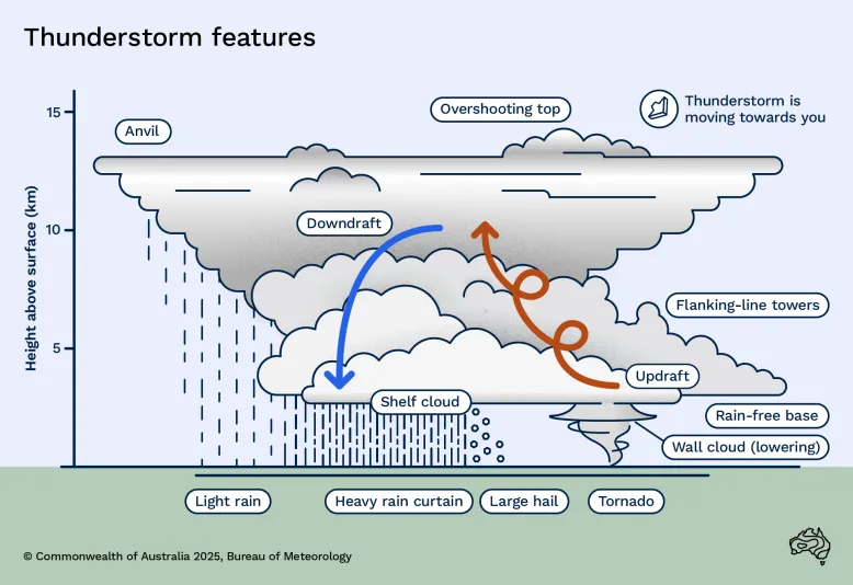
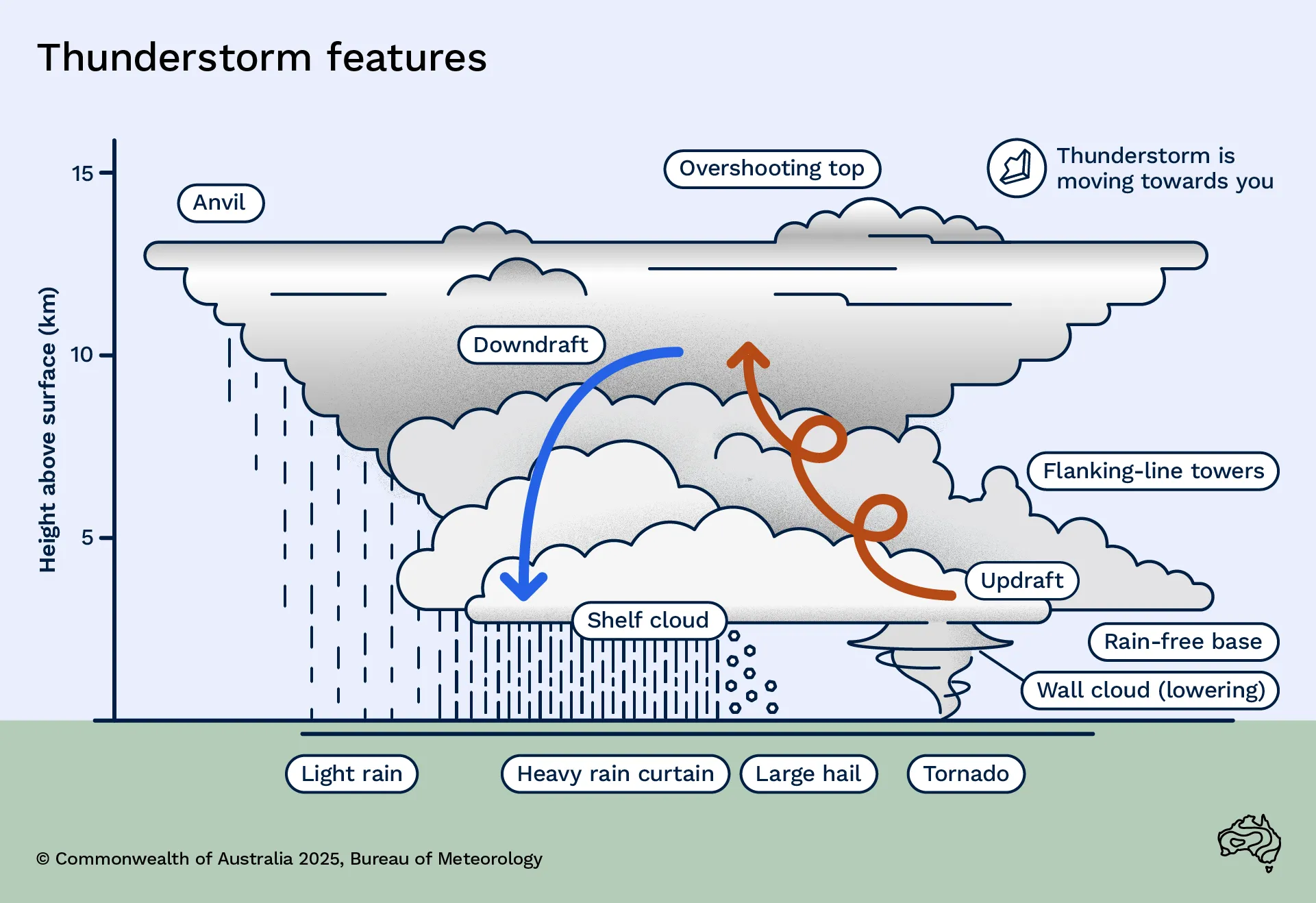
Updraft
Warm, moist air flowing into the storm, giving it energy.
Downdraft
A column of cool air that sinks toward the ground, most often along with rain.
Anvil
A flat, often wispy-looking cloud above and usually downwind of the updraft. The cloud is mainly made up out of ice crystals.
Outflow
Cool air flowing away from the storm, produced by evaporation of rain in the downdraft.
Flanking line towers
A line of cumulus clouds that connect to and extend out from the updraft of the parent cumulonimbus cloud. It usually looks like stair steps, with taller clouds closer to the parent cloud.
Wall cloud
An abrupt lowering of the cloud base. It descends from the relatively flat, rain-free base of a rotating supercell thunderstorm. Tornadoes often come from this part of the thunderstorm.
Shelf cloud
A low-level, wedge-shaped cloud marking the boundary between:
- warmer air ahead of the storm
- cool outflow air from the storm’s downdraft.
Types of thunderstorms
There are 3 general thunderstorm types: single-cell, multi-cell and supercell. Each has a distinct structure, circulation pattern, and set of characteristics.
Single-cell thunderstorm
A single-cell thunderstorm's life cycle is limited to the growth and collapse of a single updraft pulse.
The cloud forms, grows to maturity and produces a heavy downpour. It then decays as the cool outflow spreads out and descending air cuts off the original warm updraft.
These thunderstorms are most likely to happen on summer afternoons. They usually last no more than an hour and can produce strong wind gusts (microbursts). Developing single-cell storms can produce waterspouts or (over land) weak tornadoes.
It's rare to encounter a pure single-cell storm. Almost all of them have some multi-cell characteristics.
Multi-cell thunderstorm
Multi-cell thunderstorms are the most common. They consist of successive, separate updraft pulses. These pulses help maintain the system's overall strength, structure and appearance. They may be:
- very close together, so the thunderstorm is quite uniform over time, or
- widely spaced, so the thunderstorm goes through stronger and weaker phases.
Multi-cells can produce any of the thunderstorm phenomena. Tornadoes or giant hail are less common.
Supercell thunderstorm
This type of thunderstorm is very strong and can produce:
- damaging and destructive wind gusts
- heavy rainfall
- tornadoes
- large to giant hail.
They can last a long time, maintaining an almost steady state for many hours.
A supercell is distinguished by a deep and rotating updraft called a mesocyclone. This is a vortex within the thunderstorm.
Thunderstorm phenomena
Thunderstorms can bring a range of phenomena. This includes heavy rain, thunder and lightning, hail, wind gusts and even tornadoes.
To learn how these phenomena appear on our weather map and rain radar, see Understanding weather radar images.
Thunder and lightning
Lightning is electrical discharge. It happens when there are large voltage differences between:
- the ground and part of the storm, or
- between parts of the storm.
The difference in voltage needs to be several million volts. That is, large enough to overcome the insulating effect of the air.
Lightning strikes can happen:
- within the cloud
- between clouds
- between clouds and the ground.
Thunder is the sound produced by the explosive expansion of air. The lightning heats the air to temperatures as high as 30,000° C.
To see the annual variation in thunderstorm and lightning activity across Australia, view the average annual thunder day and lightning flash density maps.
Hail
Hail is solid precipitation, in the form of balls or pieces of ice known as hailstones.
Hailstones can form in a thunderstorm with a strong updraft. Small particles of snow with a thin crust of ice (called graupel) are suspended in the updraft. They can sweep up small cloud droplets, which freeze onto the graupel surface. This means they can grow fast.
Hailstone diameter can range from 5 mm to more than 100 mm. Most are smaller than 25 mm. Hailstones larger than lawn bowls have been recorded in Australia. For example, a hailstone with a maximum diameter of 160 mm was recorded during a hailstorm in Yalboroo, Queensland on 19 October 2021.
Damage from hailstones may include:
- crop damage from small hailstones (less than 20 mm diameter)
- vehicle damage from larger hailstones (more than 20 mm diameter)
- widespread damage from giant hailstones (greater than 50 mm diameter).
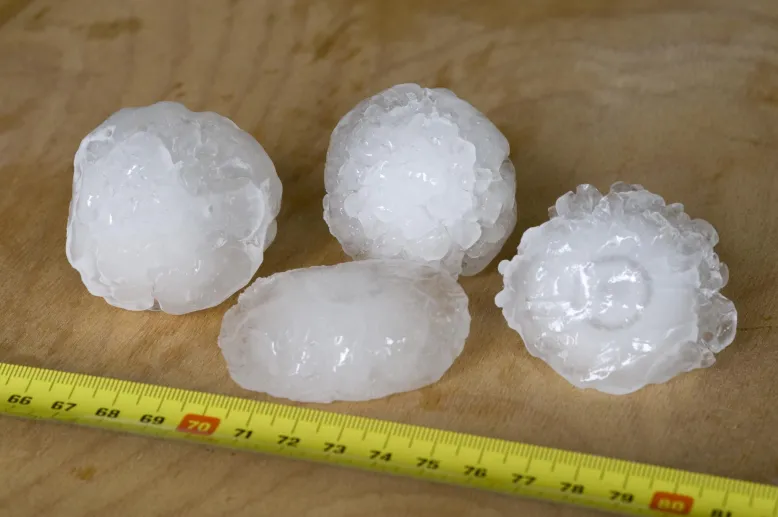
Giant hailstones measuring 5 cm across
Wind gusts
In a mature thunderstorm, falling rain and hail drag the surrounding air downwards. Evaporation from the raindrops and melting ice cools the nearby air. This creates a cold dense bubble of air that speeds down towards the ground.
When it reaches the ground, this downdraft creates a dome of cool air. It can spread sideways very quickly, producing a cool, gusty wind that can cause damage. Strong winds in the lowest 2 km of the atmosphere can enhance the downdraft.
Learn more about wind, gusts and squalls in our Marine knowledge centre.
Tornadoes
Tornadoes do happen in Australia and have caused significant damage. They are the rarest and most violent thunderstorm phenomena. Learn more about Tornadoes.