


Ord: Key findings
For the water account period 1 July 2024 to 30 June 2025
- Rainfall in the Ord region during 2024–25 was above average for the third consecutive year.
- Streamflows remained below average across the region throughout much of the reporting period, despite above-average rainfall, with flows at all sites less than half the long-term average during the northern wet season.
- Approximately 30% of the water resources accessible for take in the Ord region were used, primarily for surface water diversions to irrigation and agricultural users.
Climate and water
Rainfall

878 mm
27% above the average of 692 mm
Streamflow

below average
inflows into Lake Argyle
Storage

96.2% full

15.7% less than last year
Water use from all sources
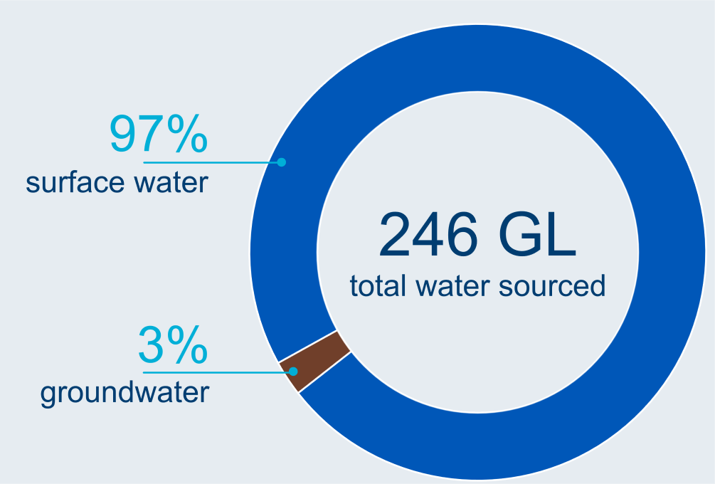
Water sourced
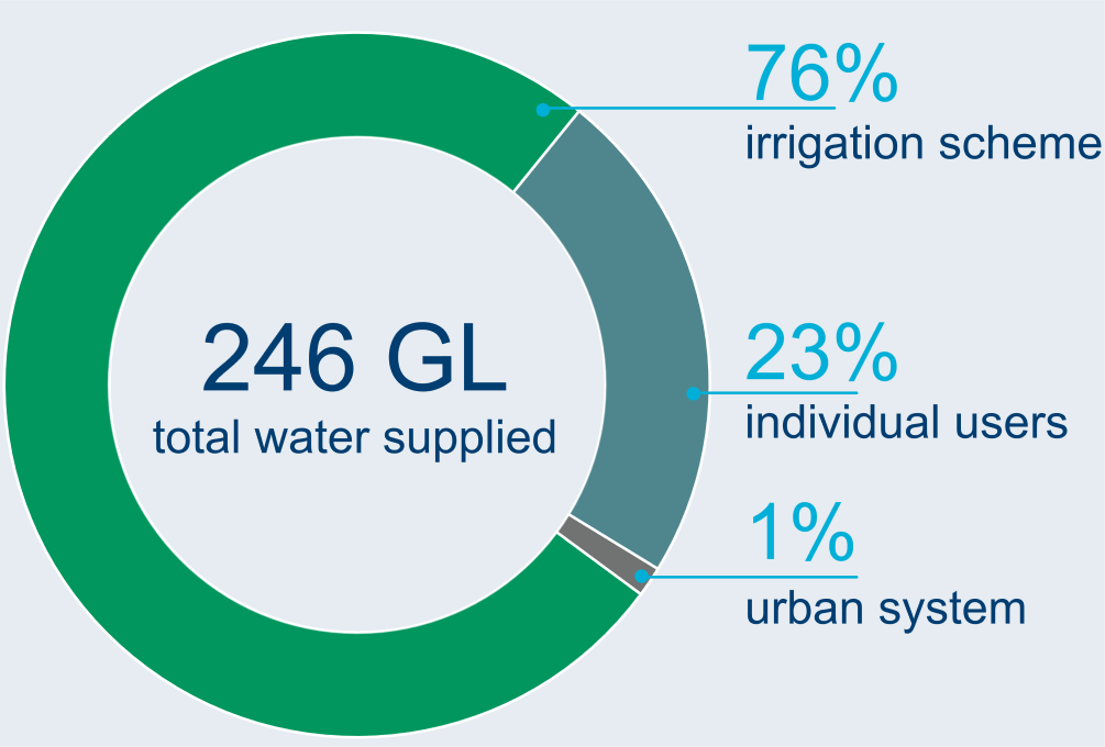
Water supplied
Water status of water resources
Water availability
17,146 GL
surface water available in 2024–25
39% less than last year
Water accessible
867 GL
total surface water and groundwater accessible in 2024–25
same as last year
Water taken
246 GL
total surface water and groundwater taken in 2024–25

slightly more than last year