


Ord: Key findings
For the water account period 01 July 2021 – 30 June 2022
- Total annual rainfall for the 2021-22 year was below average.
- Below-average runoff and surface water inflows resulted in the region's storage volumes decreasing from 75% full at 30 June 2021 to 70% full at 30 June 2022.
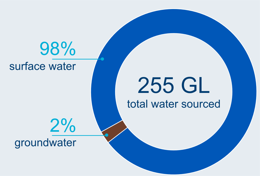
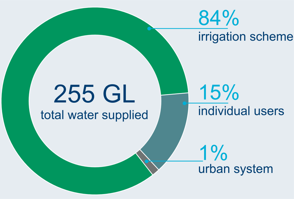
- Water taken from surface water and groundwater resources for consumptive use was 255 GL, 8% less than last year.
Climate and water
Rainfall

618 mm
10% below the average of 685 mm
Streamflow

below average
inflows into Lake Argyle
Storage

70% full

5% less than last year
Water use from all sources
Water sourced
Water supplied
Water status of water resources
Water availability
10,954 GL
total surface water available in 2021-22

2% less than last year
Water accessible
821 GL
total surface water and groundwater accessible in 2021-22

8% more than last year
Water taken
255 GL
total surface water and groundwater taken in 2021-22
8% less than last year