


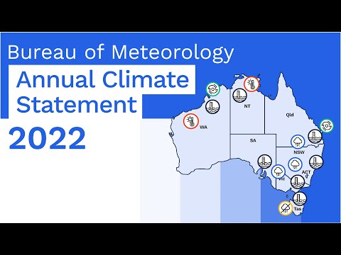

Wetter and warmer than average for Australia overall
- Australia's national mean temperature was 0.50 °C warmer than the 1961–1990 average, making 2022 the equal-22nd-warmest year on record.
- The mean annual maximum temperature was above average for most of northern Australia, Tasmania, and parts of the west coast, but below average for New South Wales, southern Queensland, and parts of South Australia.
- The mean annual minimum temperature was above or very much above average for the majority of Australia.
- It was especially warm for the tropics, with severe to extreme heatwave conditions affecting parts of the north and the west several times during 2022.
- Nationally-averaged rainfall was 26% above the 1961–1990 average at 587.8 mm, which makes 2022 the ninth-wettest year on record for Australia.
- Rainfall was very much above average for the south-eastern quarter of the mainland, compared to all years since 1900, but below average for western Tasmania, much of the north of the Northern Territory, and the far south-west of Western Australia.
- In eastern Australia, persistent rain saw significant flooding affecting large areas multiple times during the year.
- Water storage levels have been high across much of Australia during 2022, although some storages remained at low levels in parts of central coast Queensland, western Tasmania, south-east New South Wales, and western Victoria.
- The main climate influences active during 2022 were La Niña, which persisted through summer 2021–22, dissipated during autumn, then re-developed in early September and continued through the end of 2022; a negative Indian Ocean Dipole in winter and spring; and a persistently positive phase of the Southern Annular Mode from mid-autumn onwards.
Confluence of climate drivers brings exceptionally wet year for the mainland south-east


Australia's area-averaged mean temperature for 2022 was 0.50 °C above the 1961–1990 average. The mean maximum temperature was 0.32 °C above average and the mean minimum temperature was 0.67 °C above average. The national temperature dataset, ACORN-SAT, commences in 1910 and spans 113 years of observations.
2022 was Australia's equal-22nd-warmest year on record, compared to all years since 1910, and the coolest year since 2012.
Annual mean temperatures for 2022 were above average for northern Australia; Tasmania, most of Victoria, and south-east South Australia; and large parts of the west and north of Western Australia. Conversely, the annual mean temperature was below average for a large area of central to northern New South Wales inland of the coastal ranges.
Nationally, 2022 was Australia's ninth-wettest year on record. Rainfall for Australia was 26% above average for the nation as a whole at 587.8 mm (compared to the 1961–1990 average of 466.0 mm). The national rainfall dataset commences in 1900.
Rainfall for the year was above average for most of mainland Australia, and very much above average for the south-eastern quarter of the mainland. Rainfall was below average for western Tasmania, much of the central and eastern Top End in the Northern Territory, and for the far south-west of Western Australia.
In eastern Australia, persistent rain saw significant flooding affecting large areas multiple times during the year. Flooding affected south-eastern Queensland and eastern New South Wales from late February into March, in inland central and northern Queensland and inland northern New South Wales during May, around Sydney and the New South Wales coast in early July, and across large parts of the eastern states from August, with flooding affecting many parts of the Murray–Darling Basin over prolonged periods or on multiple occasions throughout spring. In Western Australia the Kimberley was affected by flooding both near the start and the end of the year.
High rainfall, wet soils, and high streamflows also meant that water storage levels were high across much of Australia during 2022, with storages in parts of northern Australia and south-east Queensland that started the year well below capacity experiencing significant increases during February. However, water storages remained low for some regions, including parts of central coast Queensland, western Tasmania, south-east New South Wales, and western Victoria.
Following a wetter than average year for much of the eastern mainland during 2021, below to very much below average rainfall during summer 2021–22 saw serious rainfall deficiencies (totals in the lowest 10% of historical observations since 1900) emerge across western Tasmania and parts of coastal southern Australia. Despite heavy rain and periods of flooding in eastern Australia, these rainfall deficiencies persisted into spring 2022 for much of the west-facing coasts of south-eastern Australia, and in western Tasmania were still in place at the end of the year.
La Niña had been declared in late November 2021, and persisted through early 2022 before weakening over autumn and returning to neutral before a third successive La Niña re-emerged in early September. Three consecutive La Niña events are rare but not unprecedented, with previous instances occurring during 1954–57, 1973–76, and 1998–2001. A negative Indian Ocean Dipole (IOD) during winter and spring, and a persistently positive phase of the Southern Annular Mode (SAM) from mid-autumn, also influenced Australia's climate and weather patterns during 2022.
For most capital cities the mean maximum temperature for 2022 was within one degree of average, compared to observations in recent decades (see table caption below for details of averaging periods). Canberra was a notable exception, with daytime temperatures 1.8 °C below average. For Darwin, the mean maximum temperature was the equal-fifth-highest on record. All capital cities had annual mean minimum temperatures within half a degree of average. 2022 was the wettest year on record for Sydney; amongst the ten wettest years on record for Brisbane and Canberra; and within 15% of average for Hobart, Adelaide, Perth, and Darwin.
| Opened | Maximum temperature | Minimum temperature | Rainfall | |||||||
|---|---|---|---|---|---|---|---|---|---|---|
| 2022 average (°C) |
Anomaly (°C) |
Comment | 2022 average (°C) |
Anomaly (°C) |
Comment | 2022 total (mm) |
Anomaly (%) |
Comment | ||
| Canberra | 1939 | 19.3 | −1.8 | Coolest since 1996 | 7.1 | +0.3 | 892.4 | +43 | 7th-wettest | |
| Brisbane | 1840 | 25.7 | −0.9 | Coolest since 2008 | 16.4 | 0.0 | Coolest since 2012 | 2036^ | +91^ | 5th-wettest, wettest since 1974 |
| Sydney | 1858 | 22.6 | −0.3 | Coolest since 2011 | 14.4 | −0.3 | 2530.0 | +121 | Wettest on record | |
| Melbourne | 1855 | 20.0 | N/A* | 11.6 | N/A* | 699.4 | N/A* | |||
| Hobart | 1882 | 17.6 | 0.0 | Coolest since 2011 | 9.2 | +0.2 | 700.0 | +14 | ||
| Adelaide | 1839 | 21.8 | −0.8 | Coolest since 1996 | 12.6 | +0.2 | 612.4 | +13 | ||
| Perth | 1876 | 25.2 | +0.4 | 13.1 | +0.2 | 701.6 | −5 | |||
| Darwin | 1941 | 32.9 | +0.5 | Equal-5th-warmest | 23.8 | +0.5 | 1972.2 | +8 | Wettest since 2017 | |
Table of annual rainfall, temperature and sea surface temperature values and ranks
Table of annual national rainfall, temperature, and sea surface temperature anomalies and ranksLike last year, 2022 warmer than average despite La Niña and negative IOD

While La Niña tends to result in cooler annual mean temperature for Australia, the greatest effect on Australian mean temperature is observed over financial years (July–June), rather than calendar years, as this more closely matches the typical autumn to autumn life cycle of ENSO events.
For Australia as a whole, the annual national mean temperature for 2022 was 0.50 °C above the 1961–1990 average. The mean maximum temperature was 0.32 °C above average and the mean minimum temperature was 0.67 °C above average. The national temperature dataset, ACORN-SAT, commences in 1910, spanning 113 years.
2022 was Australia's equal-22nd-warmest year on record, and the coolest year since 2012. The record-breaking La Niña events of 2010–11 and 2011–12 led to each of 2010, 2011, and 2012 being cooler than both the eight years before and the eight years after this period.
2022 also joins 2021 as only the second year since 2013 not amongst the ten warmest years on record for Australia. Despite both 2021 and 2022 being cooler than recent years, in part as a result of persistent La Niña and high rainfall, the mean temperature for the ten years from 2013 to 2022 was the highest on record, at 1.01 °C above the 1961–1990 average, and 0.40 °C warmer than the ten year period between 2001 to 2010. Only six years prior to 2000 were warmer than 2022.
Compared to the distribution across all years since 1910, annual mean temperatures for 2022 were above average for most of northern Australia, large parts of the west and north of Western Australia, Tasmania, most of Victoria, and south-east South Australia. They were very much above average (in the highest 10% of historical observations, decile 10) for most of the northern tropics. Conversely, a large area of central to northern New South Wales west of the ranges had mean temperatures that were cooler than average.
Maximum temperatures for the year were above or very much above average across most of the northern tropics, along the west coast of Western Australia, and for Tasmania, compared to the distribution across all years since 1910. The annual mean maximum temperature was very much above average across most of the northern tropics and western Tasmania. The mean maximum temperature was below average for a large area of the eastern to southern mainland, taking in New South Wales, southern Queensland, parts of northern Victoria, and large parts of pastoral South Australia. For much of New South Wales, extending into southern Queensland, the annual mean maximum temperature was very much below average (in the lowest 10% of historical observations, decile 1).
Minimum temperatures for the year were above average for most of Australia, and very much above average across much of the north, the south-east, along the north-western coast of Western Australia, and in inland south-east Western Australia.
Most months were warmer than average for large parts of Australia during 2022. It was especially warm for the tropics, with severe to extreme heatwave conditions affecting parts of the north and the west several times during 2022.
Warm sea surface temperature anomalies to the west and north-west of Western Australia, and a ridge of high pressure south of the Great Australian Bight (associated with positive Southern Annular Mode across most of summer 2021–22), played an important role early in the year, with extreme heatwave conditions affecting the north and west throughout summer and into autumn (see events section for details of specific records). The presence of warm sea surface temperature anomalies around the coast decreased the temperature contrast between land and ocean — a condition necessary to drive sea breezes. The location of the high pressure system was further west than is typical, and favoured a predominantly easterly wind pattern over Western Australia that worked against the formation of cooling sea breezes along the coast.
July was unusually cool for large parts of the tropics due to unusual dry-season rainfall, although further south much of south-west Australia and parts of the south-east continued to experience warmer than average days and nights.
During August, September, October, and December far northern Australia again experienced warmer or very much warmer than average mean minimum and mean maximum temperatures, and extreme heatwave conditions in some parts of the tropics.
In the south, spring brought a turn to well above average rainfall for much of Australia, and cooler or much cooler than average days for most of the mainland south of the tropics.
Persistent heavy rain during October also saw a strong response in diurnal temperature range in the south-east. During very wet periods increased cloud cover, high humidity, and saturated soils commonly lead to a low diurnal temperature range (the difference between daily maximum and minimum temperatures), with both lower daytime temperatures and warmer nights. The diurnal temperature range for October was the lowest on record for New South Wales and the fourth-lowest on record for Victoria.
November was a particularly cool month for Australia as a whole, with both mean maximum and mean minimum temperatures below or very much below average for most areas except the very far north. The area-average mean maximum temperature for November was the eighth-lowest on record, and both daytime (mean maximum) and night-time (mean minimum) temperatures were the coolest for November for Australia as a whole since 1999.
December was cooler than average for much of eastern Australia, with the mean maximum temperature in the lowest 10% of historical observations (compared with all Decembers since 1910) for much of New South Wales, mostly inland of the coastal ranges. Cold outbreaks during the month brought unusually low temperatures over south-eastern Australia, with a large number of stations observing a record-low daily minimum temperature during the first half of December.
Area-average temperatures
| Maximum Temperature | Minimum Temperature | Mean Temperature | |||||||
|---|---|---|---|---|---|---|---|---|---|
| Rank (of 113) |
Anomaly (°C) |
Comment | Rank (of 113) |
Anomaly (°C) |
Comment | Rank (of 113) |
Anomaly (°C) |
Comment | |
| Australia | = 82 | +0.32 | 99 | +0.67 | = 91 | +0.50 | |||
| Queensland | 65 | +0.29 | 104 | +1.17 | 10th-highest | 95 | +0.74 | ||
| New South Wales | = 22 | −0.48 | 94 | +0.73 | = 67 | +0.13 | |||
| Victoria | 51 | −0.13 | 111 | +1.03 | 3rd-highest (record +1.14 °C in 2016) | 93 | +0.45 | ||
| Tasmania | 104 | +0.67 | 10th-highest | = 101 | +0.46 | = 103 | +0.57 | equal-10th-highest | |
| South Australia | = 49 | −0.09 | 82 | +0.38 | 71 | +0.15 | |||
| Western Australia | 90 | +0.61 | = 94 | +0.38 | 93 | +0.50 | |||
| Northern Territory | 94 | +0.69 | 98 | +0.68 | 99 | +0.69 | |||
*Rank ranges from 1 (lowest value on record) to 113 (highest value on record). The national temperature dataset commences in 1910.
A rank marked with '=' indicates that a value is shared by two or more years, resulting in a tie for that rank.
^Anomaly is the departure from the long-term (1961–1990) average.
In climatology a baseline, or long-term average, is required against which to compare changes over time. The Bureau uses the 1961–1990 period as the climate reference period for the Annual Climate Statement and other climate monitoring products. It has no bearing on the calculation of trends over time, or the ranking of one year compared to all other years in a dataset.
Australia's ninth-wettest year on record, wettest spring on record for the south-east
Nationally, the area-average annual rainfall total for Australia was 26% above the 1961–1990 average at 587.8 mm (the 1961–1990 average is 466.0 mm). This makes 2022 the ninth-wettest year on record for Australia (compared to all years since 1900).
Rainfall was above average for most of mainland Australia, and very much above average (decile 10, the highest 10% of historical observations) for most of the south-eastern quarter of the mainland, excluding the southern coast of Victoria and south-east South Australia. Rainfall for the year was also very much above average for parts of east coast Tasmania, parts of inland central Queensland and northern Cape York Peninsula, the south-eastern quarter of the Northern Territory, and much of the eastern half of the Kimberley in Western Australia.
Rainfall was below average for western Tasmania, much of the central and eastern Top End in the Northern Territory, and the far south-west of Western Australia.
In northern Australia, the latter part of the 2021–22 northern wet season was particularly dry, with rainfall for the 3 months February to April 2022 in the lowest 10% of historical observations for much of the northern half of the Northern Territory. A reduced number of active Madden Julian Oscillation (MJO) events (i.e. monsoon bursts) during the second half of the northern wet season was associated with a persistent pattern of MJO events stalling in the Indian Ocean and/or weakening rapidly as they approached Australia, which may have been influenced by warm waters in the Indian Ocean.
Despite the reduced number of active monsoon periods, tropical systems were responsible for bringing heavy rain from the north-west through central Australia to southern South Australia in January, and for causing significant flooding in Queensland in the Wide Bay and Burnett districts in early January, and again in late February to March in south-eastern Queensland and eastern New South Wales.
In the south of the country the combined influence of La Niña, generally positive Southern Annular Mode (SAM), and persistent anti-cyclones ('blocking highs') over the Great Australian Bight during summer and early autumn resulted in predominantly easterly winds over much of Australia, and lower than average rainfall over many west-facing coastlines. While La Niña typically leads to above average summer rainfall for much of eastern Australia, there is no strong signal south of the Dividing Range. Summer 2021–22 was the fifth-driest on record for Tasmania as a whole, and the driest since 1980–81.
April and May rainfall was above average for much of the eastern mainland, with flooding in some coastal catchments of New South Wales and parts of eastern Victoria in early April, and in inland central and northern Queensland and inland northern New South Wales during May.
July was very wet for the north and east of New South Wales, largely associated with an East Coast Low which caused major flooding along the coast early in the month. Conversely, rainfall was below average for most of the remainder of south-east Australia during July, and it was the fifth-driest July on record for Tasmania and South Australia.
August and September were generally wetter than average for most of Australia and the persistent rain falling onto already wet catchments led to renewed river level rises and saw flooding along many rivers in southern Queensland, inland New South Wales, northern and country Victoria. In many parts of the Murray–Darling Basin the flooding occurred over prolonged periods, or on multiple occasions, continuing to affect a number of communities throughout October and into November. Major flooding continued during December as flood waters progressed through a number of inland rivers in the south-eastern mainland states and southern Queensland. A Special Climate Statement on the ongoing floods is being prepared and will be published in due course.
Spring as a whole was the second-wettest on record for Australia as a whole, and the wettest on record for the Murray–Darling Basin, for New South Wales, and for Victoria. Numerous locations near the coast of New South Wales and in southern Queensland had broken their annual rainfall record by the end of October following the sequence of very wet months, and for Victoria October was the state's wettest month on record for any time of the year.
December rainfall was above average for the northern tropics, and was the seventh-wettest December on record for the Northern Territory, but saw average to below average rainfall for the southern half of Australia. Tropical cyclone Ellie produced heavy rainfall over northern and central parts of the Territory during the last week of the year, and continued to produce heavy rainfall over central and northern parts of the Territory and parts of the Kimberley once falling below cyclone strength. Significant flooding occurred on the Fitzroy River, with further heavy rain continuing into the start of 2023.
Based on observations from Darwin Airport, onset of the Australian monsoon likely occurred on 22 December, slightly earlier than the long-term average date of 28 December (based on observations since 1957). During La Niña, the monsoon onset date at Darwin is typically earlier than usual.
Rainfall deficiencies
Summer rainfall (December 2021 to February 2022) was below or very much below average across large parts of western and southern Western Australia, south-east South Australia and western to central southern Victoria, much of Tasmania, large areas of northern and central Queensland south of Cape York Peninsula, and across the base of the Top End in the Northern Territory.
As a result, serious rainfall deficiencies (totals in the lowest 10% of historical observations since 1900) emerged across western Tasmania and parts of coastal southern Australia for the period commencing December 2021. A pocket of Queensland's Central Coast and Capricornia districts around and inland of Rockhampton also saw serious or severe rainfall deficiencies at this timescale.
As autumn passed and the year moved into winter, despite very heavy rainfall along parts of the east coast, rainfall remained close to average or below average for large areas of the west-facing coasts of south-eastern Australia, resulting in the persistence of rainfall deficiencies in these areas.
May rainfall was above average for Australia as a whole, and above to very much above average for most of Queensland and New South Wales. The exceptional rainfall also cleared rainfall deficiencies for the period commencing December 2021 from affected areas of Queensland.
Although July rainfall was below or very much below average for much of South Australia, Victoria, and Tasmania, rainfall was above average for each month from August through November for much of Australia including the southern mainland, raising rainfall totals for the period commencing December 2021 out of the lowest 10% of historical observations along the southern coastline. While Tasmania received above average rainfall in some months, totals in the west of the state were generally close to average or below average, and serious or severe rainfall deficiencies persisted in western Tasmania, and were still in place at the end of December 2022.


December 2021–February 2022, December 2021–April 2022, December 2021–July 2022, December 2021–October 2022, and December 2021–December 2022.
Serious deficiency corresponds to decile 1 rainfall, based on all years since 1900. About deciles.
Tropical cyclones
Ten tropical cyclones were observed in the broader Australian region during the 2021–22 tropical cyclone season, close to the long-term average of eleven (average for all seasons since 1969–70), but above the average of nine over the last decade. While the number of systems reaching tropical cyclone strength was slightly below average, the season saw a very high number of tropical lows, some of which caused significant weather (e.g. in February tropical low 14U brought heavy rain causing flooding in the Fitzroy River in the Kimberley).
Two tropical cyclones reached severe (category 3) strength in the Australian Region (Tropical Cyclone Vernon and Tropical Cyclone Charlotte), but both stayed well off-shore. Two systems crossed the coast at cyclone strength (Tropical Cyclone Tiffany and Tropical Cyclone Anika).
Tiffany caused heavy rain along its path in the Top End and Kimberley, with rain continuing to accompany the remnant low through inland Western Australia and parts of outback South Australia, resulting in significant disruption to long-distance transport routes. Anika brought high winds and heavy rain along the Kimberley coast and eastern Pilbara. While Tropical Cyclone Seth did not cross to coast at cyclone strength, it went on to cause severe flooding in south-east Queensland and hazardous surf along the south-eastern coast of Australia as a remnant low.
As of 31 December 2022, the 2022–23 tropical cyclone season had seen three tropical cyclones (the unnamed 01U, Tropical Cyclone Darian, and Tropical Cyclone Ellie). Darian reached category 5 strength, but was located far from land over the Indian Ocean. Ellie crossed the Top End of the Northern Territory as a category 1 system in late December, bringing heavy rain over the region and causing significant flooding in the Fitzroy River which continued into January 2023, with significant damage to transport infrastructure.
The tropical cyclone season typically runs from 1 November to 30 April, although tropical cyclones can and do form outside of those bounds. All tropical cyclones existing between 1 July and 30 June the following year count towards the season total. The broader Australian region covers the area south of the equator and between 90°E and 160°E, and includes Australian, Papua New Guinea, and Indonesian areas of responsibility.
For more information on tropical cyclones, see the Tropical Cyclone Knowledge Centre.
Area-average rainfall
| Rank (of 123) |
Average (mm) |
Departure from mean |
Comment | |
|---|---|---|---|---|
| Australia | 115 | 587.8 | +26% | 9th-highest; highest since 2011 |
| Queensland | 105 | 778.1 | +25% | |
| New South Wales | 122 | 863.6 | +55% | 2nd-highest (record 916.5 mm in 1950) |
| Victoria | 119 | 873.1 | +32% | 5th-highest; highest since 1974 |
| Tasmania | 55 | 1321.6 | −3% | |
| South Australia | 112 | 310.8 | +39% | |
| Western Australia | 105 | 417.1 | +22% | |
| Northern Territory | 96 | 613.2 | +12% | |
| Murray–Darling Basin | 120 | 731.9 | +49% | 4th-highest (record 812.2 mm in 2010) |
*Rank ranges from 1 (lowest value on record) to 123 (highest value on record). The national rainfall dataset commences in 1900.
A rank marked with '=' indicates that a value is shared by two or more years, resulting in a tie for that rank.
^Departure from mean is relative to the long-term (1961–1990) average.
In climatology a baseline, or long-term average, is required against which to compare changes over time. The Bureau uses the 1961–1990 period as the climate reference period for the Annual Climate Statement and other climate monitoring products. It has no bearing on the calculation of trends over time, or the ranking of one year compared to all other years in a dataset.
Water resources
- Significant flooding affected south-eastern Queensland in January before extreme multi-day rainfall in late February and March produced record-breaking floods in south-east Queensland and eastern New South Wales.
- Major flooding was experienced throughout the Murray–Darling Basin from June to December, with large volumes of flood water moving downstream into South Australia during December.
- High streamflows were observed at many southern Australian sites, mostly in New South Wales and at some sites in the Kimberley and west coast of Western Australia.
- Low streamflows were observed mostly in south-west Western Australia, in the Top End of the Northern Territory, and along the north-east coast in Queensland.
- With high streamflows and inflows, many storages across Australia remained at or above full supply capacity for much of 2022, including most of those in the Murray–Darling Basin. Some regions experienced low storage levels during most of 2022, including parts of central Queensland, western Victoria, western and central Tasmania, south-west Western Australia, and south-east New South Wales.
In 2022, the status of many of Australia's water resources was influenced by above average rainfall and wet soil conditions.
Extreme multi-day rainfall in late February and March produced record-breaking floods in south-east Queensland and eastern New South Wales.
During spring, widespread above average rainfall across much of Australia resulted in above average or highest on record streamflows, with extended periods of major and moderate flooding throughout the Murray–Darling Basin.
Surface water storage levels remained at near full capacity for many parts of the country across the year. However, there were some regions with low storage levels for much of 2022, particularly in parts of central Queensland, western Victoria, western and central Tasmania, south-west Western Australia, and south-east New South Wales.
Groundwater storage levels varied considerably across Australia in 2022. In areas of high rainfall and flooding, such as the Murray–Darling Basin and south-east Queensland, groundwater levels increased, with above average levels for many bores. This contrasted with below average groundwater levels along the Victoria–South Australia border and in the Top End of the Northern Territory.
Soil moisture
Soil moisture in the root zone (soil moisture in the top 100 cm) was above average at the start of 2022 across most of the eastern Murray–Darling Basin, eastern Victoria, much of South Australia, the Top End of the Northern Territory, and parts of Cape York Peninsula in Queensland. Soil moisture was below average for western Tasmania, western Victoria and south-east South Australia, large parts of the South West Land Division and southern Western Australia.
Soil moisture decreased over summer but increased significantly again over autumn across the eastern mainland, with root zone soil moisture very much above average (decile 10, highest 10% of historical observations since 1911) from eastern Victoria to south-east Queensland in March and April. In May and June, there was a return to average soil moisture in Victoria and the east coast of New South Wales, and a continuation of above average soil moisture for much of the remainder of the eastern mainland.
In western Tasmania, soil moisture persisted at very much below average to lowest on record from January to May following multiple months of below or very much below average rainfall for the west of the state. It was not until June that soil moisture in western Tasmania increased to above average.
During spring, soil moisture was above average across much of Australia, although remaining below average for south-west Western Australia and south-west Tasmania during September and October. During November, highest on record soil moisture was observed for parts of New South Wales, northern Victoria, central and south-east South Australia, the central west of the Northern Territory, and north-west Western Australia.


Mostly above average streamflows

For 2022 as a whole, streamflows were above average to highest on record across much of Australia (compared to all years since 1975). High streamflows were mostly observed in Victoria, northern and eastern Tasmania, south-east Queensland, much of New South Wales, and at some scattered sites in Western Australia.
Highest on record streamflows were observed at 35% of the 924 sites where streamflow is measured and which had at least 80% of daily observations available during 2022. Higher than average streamflows were measured at 75% of sites. Streamflows were average at 18% of sites, and below average or very much below average at 7% of sites, mostly in Western Australia, northern Queensland, and the Top End of the Northern Territory.
| Streamflow decile category | Number of sites | Percentage of sites (%) |
|---|---|---|
| Highest on record | 327 | 35 |
| Very much above average | 231 | 25 |
| Above average | 143 | 15 |
| Average | 167 | 18 |
| Below average | 53 | 6 |
| Very much below average | 2 | 1 |
| Lowest on record | 1 | 0 |
Floods across eastern Australia
During 2022 Australia experienced multiple severe flooding events, mostly across the south-east. The two most significant flooding events occurred at the beginning and end of the year.
Extreme multi-day rainfall in south-east Queensland and eastern New South Wales at the end of February through to March resulted in record flooding in many of the catchments in the region. The intense and sustained rainfall across the region led to flash flooding and riverine flooding extending from Maryborough in Queensland to Grafton in New South Wales. Some areas of south-east Queensland, such as the Mary River at Gympie, observed their highest flood peaks since 1893. Widespread major riverine flooding also occurred in the Sunshine Coast region, and in the Brisbane, Logan and Albert river catchments. See Special Climate Statement 76 for details.
In parts of north-east New South Wales, peak flood levels surpassed previous observations by considerable margins. Extensive flooding occurred through Lismore (Wilsons River) and other nearby towns, including Coraki and Woodburn (Richmond River), and Murwillumbah and Tumbulgum (Tweed River). The rain-bearing weather system that caused floods in north-east New South Wales later shifted south along the New South Wales coast, bringing further heavy rainfall to eastern parts of the state. Flooding resulted in the Hawkesbury–Nepean River system in early March; flood heights exceeded levels reached in March 2021 and were comparable to those of 1978. Major flooding occurred again in the Hawkesbury–Nepean River during early July when an East Coast Low brought several days of very heavy rainfall around Sydney.
During spring 2022, numerous slow-moving low-pressure systems and associated troughs and cold fronts moved across the south-east of the country, bringing significant rainfall and contributing to Australia's second-wettest spring on record. This made the landscape very wet, especially in the east, with high river levels and most of the storages at or near capacity. These wet antecedent conditions and heavy rainfall in October contributed to widespread flooding through the New South Wales and Victorian regions of the Murray–Darling Basin and in eastern Tasmania.
From the beginning of October major flooding started in the various upper and lower catchments of the Murray–Darling Basin. Major flood levels were reached on the Lachlan River at Forbes, Condobolin, Euabalong, and Hillston; the Macquarie River at Warren; the Namoi River at Gunnedah and Narrabri; the Goulburn River at Shepparton and Seymour; the Murray River at Echuca, Moama, and Barham; the Campaspe River at Rochester; the Murrumbidgee River at Gundagai, Hay, and Wagga Wagga. Some of these towns observed river heights which were the highest on record. Shepparton, Forbes, Echuca and many other towns in inland New South Wales and Victoria were severely impacted. Flood peaks gradually moved downstream and in November, the Barwon River reached major flood levels at Mungindi, as did the Darling River at Bourke, Tilpa, Wilcannia, and Walgett.
In December, with mostly close to average rainfall in eastern Australia, flooding started to recede from the upper catchments of the Murray–Darling Basin. Downstream catchments of the Murray–Darling Basin are generally fairly flat, meaning that floodwaters moved slowly through the Menindee Lakes before reaching South Australia, causing major flooding at Renmark, Loxton, Blanchtown, Overland Corner, and Murray Bridge, with multiple flood peaks observed at some locations. The peak flood levels were not expected to reach the mouth of the Murray River until mid-January 2023.
High surface water volumes across most of Australia
Surface water storages that supply the major capital cities finished 2022 more than 82% full in all capitals exception Perth, which relies heavily on alternative water sources to meet supply needs.
Above average to very much above average rainfall over the summer period and through to the end of March, resulted in flood water filling many major storages in the Murray–Darling Basin. Further periods of very much above average or highest on record rainfall continued across most of the Basin from June to December 2022. Collectively, major storages across the Murray–Darling Basin ended the year with a total volume of 100%, higher than at the end of 2021 (91%). Storages in the southern Basin were at 100% by the end of 2022, and those in the northern Basin at 101%, with many storages at or above full supply levels throughout 2022.
Intense and sustained rainfall in February and March in south-east Queensland and eastern New South Wales resulted in a rapid rise in inflows to some major storages. Wivenhoe, the largest storage in south-east Queensland, reached full capacity for the first time since June 2015, with its level increasing from 57% on 23 February to over 183% on 28 February, equivalent to an increase of 1.4 million megalitres. This rapid replenishment of storages was not seen in central Queensland, where February's average rainfall made little change to already-low levels. The Nogoa Mackenzie rural system finished 2022 at 40%, higher than 28% at the end of 2021.
In northern Australia, Lake Argyle, the largest water supply storage in Australia, reached 81.8% of accessible capacity during February, mainly due to monsoon flow and an associated tropical low that developed into Tropical Cyclone Anika. Lake Argyle steadily declined throughout 2022, finishing the year at 69.5%, higher than 58% at the end of 2021.


Map showing percentage full of storage system at the end of 2022 (right).


Individual storages
Australia has over 500 major storages, several thousand small storages, and in excess of two million farm dams. More detailed water information for eleven nationally significant water management regions is provided in the National Water Account. Individual timeseries of storage volume as a percentage of capacity for major storages are available from Water Data Online. Further details on individual storages in the Murray–Darling Basin can be found in the Murray–Darling Basin Water Information Portal.
Groundwater recovering in the east

Groundwater level conditions have changed significantly over the past two years. High rainfall and flooding in some areas recharged stores that had been low due to prolonged drought conditions between 2017 and 2020. Since 2020, across all of Australia, the proportion of analysed bores with groundwater levels 'above average' increased from 14% to 41%, and conversely the proportion of bores with groundwater levels 'below average' decreased from 57% to 27%. The remaining 31% of bores observed 'average' groundwater levels in 2022.
These changes are also reflected in the groundwater level trends over the 5-year period from 2018 to 2022 – with 30% of bores showing a 'rising' trend, 48% are 'stable', and 22% are 'declining.'
High rainfall and flooding in much of eastern Australia since 2020 contributed to increased recharge and reduced pumping, which continued to restore groundwater levels. However, groundwater levels have remained low in other parts of the country due to one or more of a lack of recovery from earlier drought, below average rainfall in 2022, and long-term trends associated with extraction and climate change.
The northern Murray–Darling Basin and south-east Queensland have shown signs of recovery of groundwater levels following periods of heavy rainfall and flooding since 2021. Further high rainfall and flooding events in 2022 affected the whole Murray–Darling Basin and returned groundwater levels to pre-drought conditions in many areas, including the alluvial aquifers of the Namoi and Upper Murray river basins. Conversely the Victoria–South Australia border region has received very low rainfall over recent years, including in 2022.
In the Top End of the Northern Territory, and in particular near Katherine, after some recovery in 2021, groundwater levels for 2022 were stable or declining due to below average rainfall in the 2021–22 wet season. For example, groundwater in the Oolloo Dolostone and Tindall Limestone aquifers near Katherine reached levels similar to the historically low observations during 2018 to 2020.
In south-west Western Australia, groundwater levels have generally been in decline over the past 40 years due to decreasing rainfall and increasing groundwater demand. In efforts to restore groundwater levels, initiatives in recent years have included managed aquifer recharge and measures to reduce groundwater extraction. Average to above average winter rainfall in 2021 and 2022 resulted in recharge to superficial aquifers of the Gnangara Mound. This is an improvement from the previous two years of low winter rainfall resulting in low groundwater recharge and low groundwater levels.


Sea surface temperatures warmest on record for the Australian region as a whole

(From the NOAA Extended Reconstructed Sea Surface Temperature dataset, ERSST v5). About sea surface temperature regions and deciles.
The annual 2022 sea surface temperature (SST) anomaly for the Australian region was the highest on record; 0.80 °C above the 1961–1990 average based on data from the NOAA Extended Reconstructed Sea Surface Temperature dataset, ERSST v5. Above average annual SSTs have been observed for the Australian region for every year since 1995. See State of the Climate 2022 for further information on long-term change in SSTs.
SSTs were very much warmer than average (i.e. in the highest 10% of historical observations, compared to all years since 1900) around nearly all of Australia for the year as a whole, and were highest on record across large areas of the waters to the north of Australia, across much of the Arafura Sea and the Coral Sea, extending across parts of the southern Maritime Continent region, through parts of the western Pacific Ocean, across the Tasman Sea, and to the south-west of Tasmania.
SSTs remained high throughout the year, with notable areas of highest on record SSTs in the region to the south-west and south of Tasmania or between Tasmania and New Zealand during February to June, and in parts of the Coral Sea from April to December.
For the Australian region as a whole, SSTs for each month from January to October were amongst the three warmest on record for their respective month, while November was the sixth-warmest and December the 11th-warmest.
In addition to the background warming of global SSTs (see climate change section), record-warm SSTS during 2022 were most likely related to several climate drivers, including La Niña in the Pacific Ocean and the negative Indian Ocean Dipole in the Indian Ocean, both of which tend to push warmer waters towards Australia in their respective ocean basins.
These warm waters around Australia also have an influence on our climate as they act as a source of moisture through evaporation, increasing humidity, cloudiness, and the chance of rainfall. When the synoptic systems align, features such as north-west cloud bands can draw tropical moisture far into the southern and eastern states of Australia, such as happened during March 2022, contributing to heavy rainfall over a wide area.
In the Indian Ocean Basin SSTs were warmer than average across waters close to Australia throughout the year. However, as the negative Indian Ocean Dipole (IOD) developed from late autumn small areas of cooler than average SSTs were seen to emerge close to the coast around the Horn of Africa, and spread into parts of the west of the Indian Ocean basing during July, with the temperature gradient created by the difference in SST anomalies between the east and west of the basin breaking down as the event weakened during spring. By November SSTs were mostly close to average across the Indian Ocean, including in waters around the west of Australia.
The emergence of cooler than average SSTs close to the coastline of New South Wales in December was associated with a stalled low pressure system over that part of the Tasman Sea during mid-December, accompanied by a blocking high farther to the south. This synoptic situation facilitated cooling of the ocean surface.
For the globe as a whole, SSTs were the highest on record for June, October, November, and December, and amongst the five highest on record for their respective month for the other months of 2022. Globally, the average annual sea surface temperature for 2022 was 0.66 °C above the 1961–1990 average, the warmest on record in the ERSST v5 dataset (which commences in 1854). The second-warmest through fourth-warmest years on record were 2019 (+0.64 °C), 2016 (+0.63 °C), and 2020 (+0.59 °C) respectively, and all but one (2013) of the last ten years have been amongst the ten warmest on record.
The black line shows the 11-year moving average. The value for the 11-year average is positioned over the middle year of each 11-year block.
Antarctic sea-ice extent reaches new record-low seasonal minimum
Antarctic sea ice is a key indicator of the health of the southern polar region and the global climate. The extent of sea ice around Antarctica varies significantly over the course of the year, with the lowest extent occurring in February and the highest in September.
In recent years, the extent of Antarctic sea-ice cover has been at or near record lows. The net sea-ice extent around Antarctica in February 2022 was the lowest on record (~1.9 million km2), based on near continuous satellite imagery since 1979. And net sea-ice extent was well below or at record low values for all of 2022. The net values, however, do not fully reflect the regional variability. During 2022 the sea-ice extent in the Ross and Amundsen seas was 1 to 3 standard deviations above average, reflecting the influence of the strong and persistent Amundsen Sea low pressure system.
There are several factors that contribute to the changing extent of Antarctic sea ice, including ocean and atmospheric temperature, winds, ocean currents and salinity. The loss of sea ice around Antarctica has significant implications for the global climate and the ecosystems that depend on it. As sea ice retreats, it exposes darker ocean water to sunlight, which can absorb more heat and contribute to warming. The loss of sea ice also affects the behaviour of marine species, including seals, penguins, and whales, which rely on the ice for hunting and breeding.
Sea-ice extent values are calculated from sea-ice concentrations based on satellite passive-microwave ice concentration data (Cavalieri et al., 1996, updated yearly, for 1979–2021; Maslanik & Stroeve, 1999, for observations during 2022).


Major climate influences during 2022: La Niña, negative IOD, and positive SAM
During 2022 Australia experienced several climate drivers which each typically result in wetter than average conditions for much of the country. This includes La Niña, a negative Indian Ocean Dipole, and a persistently positive phase of the Southern Annual Mode.
La Niña was declared in spring 2021, peaked in late January, then slowly declined over autumn. Oceanic indicators of the El Niño–Southern Oscillation (ENSO) returned to neutral values (neither La Niña nor El Niño) during mid-to-late autumn, although some atmospheric indicators continued to show a La Niña-like signal at the end of June. Signs of La Niña development again emerged from late winter, with a third successive La Niña becoming established by early September 2022. This La Niña persisted through the remainder of 2022, and had shown little sign of decline by the start of 2023.
La Niña typically increases the chance of above average rainfall for northern and eastern Australia during spring and summer, and the chance of cooler days and nights for north-east Australia. La Niña is also often associated with longer duration of heatwaves and warm spells in south-eastern Australia during the warm season, but with lower peak intensity.
Back-to-back La Niña events are not uncommon, and have occurred in approximately half of all past events since 1900, however three La Niña events in a row is less common. Previous instances have occurred only three times since 1900 in the Bureau's records: 1954–57, 1973–76, and 1998–2001. Both 1998−2001 and particularly 1973−76 were associated with widespread and prolonged flooding, as during recent years.
During winter and spring the Indian Ocean Dipole (IOD) was in a negative phase. Signs of negative IOD development began from late autumn, with the IOD index tipping over negative IOD thresholds (i.e. at or cooler than −0.4 °C) by the end of June. The negative IOD remained very strong from July through to September, before weakening over spring and dissipating by late November, consistent with the typical timing of an IOD breakdown.
A negative IOD increases the chances of above average winter–spring rainfall for much of southern and eastern Australia, and likely contributed to the above average rainfall observed during late winter and spring. Maximum temperatures are also more likely to be below average across southern Australia during a negative IOD, while across northern Australia warmer than average temperatures are more likely.
When La Niña and negative IOD conditions combine, the likelihood of above average rainfall over Australia is further increased, particularly for the eastern half of the continent. Together they also increase the chances of warmer nights for northern Australia, and cooler days for much of the eastern mainland.
Since 2000, the only years in which cool season rainfall (April to October) has been significantly above average in southern Australia have been those which have had one or both of a significant La Niña event or a significant negative Indian Ocean Dipole event.
During 2022 April to October rainfall was above or very much above average for almost all of the eastern states, and much of the west of the country. Cool season rainfall was the highest on record since 1900 for some areas of the Murray–Darling Basin in New South Wales and Victoria, and inland areas of central Queensland. However, it was average or below average in western-facing areas of southern Australia – the south-west of Western Australia, western Tasmania and south-eastern South Australia.
For southern Australia as a whole (south of 26°S, the South Australia – Northern Territory border), it was the second-wettest cool season since records commenced in 1900, behind only 1974. It is also only the fourth time this century; after 2005, 2010, and 2016; that cool season rainfall was above the 1961–1990 average. The Southern Annular Mode (SAM) was also positive for much of the time from mid-autumn, and strongly positive at times during both winter and spring. During the positive phase of SAM the belt of westerly winds circling the mid-latitudes (spanning southern Australia and the southern ocean) contracts towards the South Pole, shifting weather systems further south than their average path.
During winter positive SAM typically favours below average rainfall for parts of south-west and south-east Australia (including Tasmania); during spring favours above average rainfall over much of New South Wales; during late spring and summer favours above-average rainfall for parts of eastern New South Wales, eastern Victoria, and south-eastern Queensland; and below average rainfall in west-facing coastal areas (particularly western Tasmania).
The Southern Annular Mode is often positive during La Niña and during 2022 the persistently positive SAM was also boosted by a strong polar vortex over Antarctica (see cryosphere section).
Climate change
In addition to the influence of natural drivers, Australia's climate is increasingly affected by global warming and natural variability takes place on top of this background trend. Based on the temperature dataset ACORN-SAT, Australia's climate has warmed on average by 1.47 ± 0.24 °C between when national records began in 1910 and 2021, with most of the warming occurring since 1950. The ocean waters around Australia have also warmed significantly over the past century — rising by 1.05 °C since 1900, with eight of the ten warmest years on record occurring since 2010. The background warming trend can only be explained by human influence on the global climate. The role of climate change is further discussed in State of the Climate 2022.
There has been a significant decline in April to October rainfall observed over south-east and south-west Australia in recent decades, including in higher rainfall parts of the Murray–Darling Basin. In the south-east of Australia, there has been around a 10% decrease in April–October rainfall since the late 1990s. In the south-west of Australia April–October rainfall has declined by around 15% since 1970, with the strongest decline (19%) during May–July.
Conversely, rainfall across northern Australia has increased across all seasons when comparing rainfall during the years since 2000 to the century before.
In both northern and southern Australia observations show an increase in the intensity of short duration heavy rainfall events.
Climate projections, described in State of the Climate 2022, indicate that Australia will likely spend more time in drought and that temperatures will continue to rise, with more extremely hot days and fewer extremely cool days.
Based on data from six leading international datasets, the World Meteorological Organization (WMO) found that 2022 was the fifth- or sixth-warmest year on record, with an average global temperature 1.15 (1.02 to 1.27) °C above the pre-industrial (1850–1900) baseline. The WMO statement on the State of the Global Climate in 2022 also found that 2022 was the eighth consecutive year that the global annual mean temperature has reached at least 1 °C above pre-industrial levels, and that the past eight years (up to and including 2022) were the warmest on record for the globe as a whole.
Greenhouse gases
Concentrations of all the major long-lived greenhouse gases in the atmosphere rose again in 2022.
Measurements are made at the Kennaook / Cape Grim Baseline Air Pollution Station (KCG BAPS), at Kennaook / Cape Grim, on Tasmania's north-west coast. The air measured there has passed from the Southern Ocean, free of local pollutants, and is representative of the well-mixed southern hemisphere atmosphere. Measurements taken in these circumstances are referred to as baseline (background) and have been made at Kennaook / Cape Grim since 1976. These gases are the principle driving force of global temperature increases. Carbon dioxide is the single most important anthropogenic greenhouse gas, accounting for approximately 66% of the radiative forcing by the long-lived greenhouse gases.
By December the baseline concentration of carbon dioxide (CO2) was 415.2 parts per million in dry air (ppm). One year earlier, in December 2021, the concentration was 413.1 ppm. A decade earlier, in December 2012, the concentration was 391.2 ppm. The December 2022 value marks a 49% increase from the pre-industrial concentration of 278 ppm in 1750.
The baseline methane (CH4) concentration in December 2022 was 1864 parts per billion in dry air (ppb). This represents an increase of 17 ppb over 12 months and is 156% higher than the pre-industrial level of 729 ppb. Methane accounts for about 16% of the radiative forcing of the long-lived greenhouse gases. The baseline nitrous oxide (N2O) concentration in November 2022 was 335.4 ppb, 1.2 ppb higher than the same time in 2021, and 24% higher than the pre-industrial concentration of 270 ppb. Nitrous oxide accounts for about 7% of the radiative forcing by long-lived greenhouse gases.
The relative radiative forcings of CO2, CH4, and N2O, as well as their pre-industrial concentrations, are consistent with (and referenced in) the WMO Greenhouse Gas Bulletin No. 18 of 26 October 2022.
KCG BAPS is funded and managed by the Australian Bureau of Meteorology, and the scientific program is jointly supervised with CSIRO Oceans & Atmosphere. For more information on KCG BAPS please see:
- CSIRO Kennaook / Cape Grim greenhouse gas data
- About the Kennaook / Cape Grim Baseline Air Pollution Station
See State of the Climate 2022 for further information about greenhouse gases.
Ozone hole
The Antarctic ozone hole in 2022 closely resembled those of both 2020 and 2021, for the third consecutive year being both relatively large and deep, as well as very long-lasting. According to NASA satellite measurements, the ozone hole reached its maximum area of 26.5 million km2 on 5 October. The minimum measured value of total ozone was 97 Dobson Units (DU), on 1 and 2 October. Unusually, the 2022 ozone hole persisted until the middle of December.
Weekly measurements made by the Bureau's balloon ozonesonde program at Davis station in Antarctica show ozone in the 12–22 km altitude range decreased by approximately 75% over springtime. The lowest observed value during 2022 was 40.6 DU, recorded on the flight on 27 September. Ozone observations at Davis commenced in 2003 (20 years of data). Compared to the lowest value observed in each of those other years, the 2022 minimum was the thirteenth-lowest (eighth-highest) annual minimum in the Davis record. Ozone values continued at concentrations typical of early to mid-spring until very late in the year due to the long-lasting ozone hole, and in early December were among the lowest recorded at Davis for this time of year.
Although actions taken under the Montreal Protocol to end the use of ozone-depleting substances have been leading to an underlying slow recovery in Antarctic ozone since the year 2000, the year-to-year variability in the severity of the Antarctic ozone hole is determined primarily by meteorological conditions in the Antarctic stratosphere.
In 2022 the stratospheric polar vortex was very strong and stable, leading to a reduced transport of ozone from lower latitudes to the Antarctic region and cooler-than-average polar temperatures lasting well into spring, conditions that could promote ozone-depleting photochemical reactions. Consequently, the Antarctic ozone hole was significantly larger than the long-term spring average, and also persisted longer than is typical.
The stronger- and cooler-than-average polar vortex is also downward-coupled to the winds and temperatures of the lower atmosphere around Antarctica, enhancing the temperature difference between the tropics and the polar region, and shifting the tropospheric westerly jet stream poleward. A long-lasting and larger-than-average ozone hole also tends to cool the polar region (also steepening the tropics-to-pole temperature gradient and pushing the westerly jet stream poleward).
The poleward shift of the band of strong westerly winds that dominate the middle to higher latitudes of the southern hemisphere also shifts the associated track of the storm systems and cold fronts that move from west to east through these latitudes. These changes characterise the positive phase of the Southern Annular Mode (SAM) at the surface. Thus, the significantly larger-than-average ozone hole in 2022 could have been an additional forcing (on top of the stronger-than-average polar vortex and La Niña) contributing to the extraordinarily persistent and strong positive SAM during the last quarter of 2022.

Notable events
Tropical Cyclone Seth formed in December 2021 and fell below cyclone strength on 1 January; the remnant tropical low resulted in extremely heavy rain around Gympie in the Wide Bay and Burnett region in Queensland on the 7th, with more than 400 mm recorded in the hills to the north-west of Gympie. Major flood warnings were issued for the Mary River following rainfall totals in excess of 600 mm over the catchment. Moderate flood levels were reported on the Burnett River, and flooding affected parts of Bundaberg CBD and Bundaberg South.
Severe thunderstorms on 6 January brought large hail and heavy rain to parts of Victoria around Ballarat, damaging potato and other crops, while on the 13th severe thunderstorms hit the Portland region, bringing down a large number of trees in the area.
In the middle of January, a very hot airmass over Western Australia and strong offshore winds blocked the usual arrival of cooler sea breezes; this drove temperatures over the Pilbara to record levels. The presence of ex-Tropical Cyclone Tiffany over the Top End and Kimberley contributed additional heat into the upper atmosphere over the Pilbara. On the 13th temperatures in excess of 50 °C were observed along the north-west coast. Onslow Airport recorded a maximum temperature of 50.7 °C, a high temperature record for Western Australia and equal to the highest temperature on record for Australia. The previous Western Australian record was 50.5 °C, set at Mardie on 19 February 1998. 50.7 °C was first observed in Australia on 2 January 1960 at Oodnadatta in South Australia.
Severe-intensity to extreme-intensity heatwave conditions affected the west coast of Western Australia, from the Pilbara to the Southwest coast, just after mid-January. Between the 18th and 23rd Perth Metro had 6 consecutive days of at least 40 °C, the longest run for any month in 123 years of combined observations (from the official Perth records).
From mid-January, the remnants of ex-Tropical Cyclone Tiffany brought heavy rain to central Australia as it moved south, forming a complex low pressure system. Widespread moderate to heavy rainfall caused ponding, overland flow, and rises in local creeks, which impacted local transport networks and necessitated lengthy detours on some transport routes. Intense rainfall across parts of pastoral and southern South Australia between the 20th and 24th resulted in flash flooding. In western and central Victoria, there were further storms, heavy rain, flash flooding, and large hail on the 26th and 27th, with widespread loss of power. Parts of South Australia received more than four times their average January rainfall.
On 1 and 2 February, severe super cell thunderstorms over Brisbane city, and its outer suburbs, and Moreton Bay brought intense rainfall, downed trees, and a short-lived tornado; this resulted in delays to transport, damage to buildings, and power outages.
Heatwave conditions in the west of Western Australia contributed to Extreme to Catastrophic fire danger in early February, with ignitions across the South West Land Division on 4 February leading to multiple fires at Bridgetown, Denmark, Corrigin and Narrogin. Later in the month fires ignited by lightning affected Jerramungup, south-east of Perth on the 11th.
In Tasmania, a fire in the Franklin–Gordon Wild Rivers National Park threatened a globally significant stand of ancient Huon pines on 15 February. Rain from the 16th to 18th helped relieve conditions in the area.
A slow-moving low pressure trough led to heavy rain across south-eastern Queensland and parts of eastern New South Wales from 22 February to the end of the month, with further heavy rain in early March. Intense rainfall on already saturated catchments led to flash flooding and riverine flooding across large areas of south-east Queensland, the Wide Bay and Burnett, and the Sunshine Coast, as well as parts of New South Wales. Multi-day rainfall totals for the 6-days ending 9 am on 28 February were at least 2.5 times the February average rainfall across parts of south-east Queensland and north-east New South Wales, and in some parts of Queensland more than 5 times their monthly average. Totals for the 6 days were above 200 mm over a large area from the New South Wales Mid North Coast to the Wide Bay and Burnett District in Queensland. More than 30 sites reported 6-day totals in excess of 1,000 mm (1 metre of rain), with the highest totals mostly between the Gympie region and Numinbah on the Queensland – New South Wales border.
Widespread major flooding resulted across south-east Queensland, including on the Mary River at Gympie, which reached its highest levels since 1893; on the Sunshine Coast where levels similar to 1992 were reached; at Brisbane City, which exceeded the peak height of the 2013 floods; and on the Bremer River at Ipswich, which reached levels similar to 2013.
Minor to moderate flooding occurred in parts of New South Wales, including flash flooding in Sydney's western and inner western suburbs on 22 and 23 February. There was major flooding in north-east New South Wales as the system moved southward into the state overnight on the 27th and into the last day of the month. The Lismore levee was overtopped on the morning of the 28th, with the river level exceeding the March 1974 peak.
For more details see Special Climate Statement 76 Extreme rainfall and flooding in south-eastern Queensland and eastern New South Wales.
Following on from heavy rain up to the end of February, the development of an East Coast Low at the beginning of March resulted in further heavy rain across coastal New South Wales. Rain fell upon already wet soils, full rivers and water storages. Record flood peaks occurred at Lismore on the Wilsons River, along the Tweed River, and at Coraki and Woodburn on the Richmond River. Major flooding was observed for parts of Sydney including the Hawkesbury–Nepean River at North Richmond and Windsor. Showers and thunderstorms continued to impact flood-affected areas as another East Coast Low brought widespread rainfall and renewed flooding in the second week of March.
Later in the month, storms again brought very heavy rain to the Gold Coast, with more than 300 mm recorded in 24 hours at some locations on the 28th. Major flood warnings were issued for the Myall Creek, Narran River, and Condamine River, with major flooding occurring at Dalby and Warra on the 29th. Major flood warnings were also issued for the Tweed, Richmond, Clarence, Bellinger, and Wilsons rivers. Lismore residents were evacuated after floodwater entered the city's central business district for the second time in a month, with Byron Bay, Ballina and other Northern Rivers towns also experiencing flash flooding.
For more details see Special Climate Statement 76 Extreme rainfall and flooding in south-eastern Queensland and eastern New South Wales.
The northern and central coasts of Queensland experienced severe- to extreme-intensity heatwave conditions from late February into the middle of March. Parts of the north of Western Australia and the north of the Northern Territory also experienced heatwave conditions, with severe intensity in the north-east of the Northern Territory. March temperature records were broken at several locations in each of the Northern Territory, Queensland, and Western Australia.
At the beginning of April, a moist south-to-south-easterly airstream over south-eastern New South Wales, eastern Victoria, and north-eastern Tasmania initially saw significant rain over Gippsland, with flood warnings issued for several catchments. By the 6th, the showers had moved to the New South Wales central and southern coast and adjacent inland areas. Rain falling onto already wet catchments saw a renewed period of flooding, with evacuation orders across Greater Sydney on the 7th.
Thunderstorms with heavy rain and strong winds affected south-eastern Tasmania, with gusts over 100 km/h, and some stations, mostly in the south-east, observing daily rainfall records for May in the 24 hours to 9 am on the 6th. Flash flooding was also reported, with widespread loss of power.
Daily rainfall records were observed across much of the eastern half of Queensland, northern Queensland, and parts of New South Wales between 10 and 14 May, with large parts of Queensland having received two to eight times the average monthly total for May by the middle of the month. Flooding affected parts of Queensland from the coastal northern tropics, to areas of the Central West, and south-east Queensland.
A cold front and associated low pressure system brought storms and wind gusts in excess of 100 km/h to south-west Western Australia from 22 May with:
- large accumulations of small hailstones reported in Kulin
- heavy rain, thunder and lightning across the Perth metropolitan area on the morning of the 23rd, and severe storm warnings from Geraldton in the north, through to the south coast and east to the Goldfields
- a tornado reported at Beenong, 300 km south-east of Perth on the 23rd
- rough seas, with dangerous winds and thunderstorm warnings and a 5 m swell off Jurien Bay on the 24th.
A deep low pressure system and associated cold front tracked across south-east Australia at the end of May, bringing cold air and speckled cloud in a strong south-westerly airstream behind the front. Some stations in Victoria and New South Wales observed record-low daily maximum temperatures for May, while snow was reported settling to relatively low locations across parts of the south-east, and good falls of snow were received in Alpine areas.
A cold outbreak during the first week of June brought persistent rainfall across much of Tasmania and southern Victoria, extending into the New South Wales Southern Tablelands, with maximum temperatures around 2 to 3 °C below average over large areas. In South Australia, some stations set daily records during the 24 hours to 9 am on 5 June, with heavy rainfall, flash flooding, and damaging winds over Adelaide and the Mount Lofty region. However, records were mostly set at stations with less than 30 years of observations. In the 24 hours to 9 am on 6 June, totals of 60 to 80 mm were recorded in north-eastern Victoria, with minor flood warnings issued for the King River. In the Alpine regions, up to 50 cm of snow was reported in 48 hours, with several ski resorts starting the season one week earlier than usual.
From 4 July, an East Coast Low brought several days of very heavy rain around Sydney that resulted in major flooding of the Hawkesbury–Nepean River and extended along the New South Wales coast. A natural disaster was declared for New South Wales following the flooding from heavy rainfall. Numerous locations set new daily July rainfall records, mostly in coastal areas from the Illawarra to the Mid North Coast, including around Sydney.
A series of cold fronts and low pressure troughs swept across southern and south-eastern Australia at the start of August as a deep and complex low pressure system passed to the south of the country. Periods of damaging winds, thunderstorms, heavy rainfall and generally cool conditions resulted with flood warnings issued for catchments across inland New South Wales, Victoria, and north-eastern Tasmania. Record-high daily rainfall for August was observed at a number of stations on the inland slopes and plains in New South Wales in the 24 hours to 9 am on 5 August. The Murrumbidgee River at Wagga Wagga reached minor flood levels as it continued to rise.
A long cold front extended from a deep low pressure system located well to Australia's south, crossing the west of the continent during 15 and 16 August. The system interacted with a moist tropical cloudband, and thick cloud ahead of the front brought heavy rain along the west coast followed by widespread lighter falls farther inland. Minor flooding was reported in the mid-west and Gascoyne regions of Western Australia, including on the Avon and upper Swan rivers. A very large number of stations in west of Western Australia set records for their highest daily rainfall total for August during the 24 hours to 9 am on the 16th, including some with over 100 years of observations.
A complex low pressure system crossing the Great Australian Bight extended cold fronts over south-east Australia and into Queensland during 11 and 12 August. The low developed into a Tasman Low, bringing strong winds and heavy rain to the south-east and localised reports of hail in metropolitan Melbourne. The Tasman Low stalled in Bass Strait on the 13th and 14th, bringing multi-day rainfall totals of 50 to 100 mm over much of Tasmania and Gippsland in Victoria. A number of sites in both states set daily rainfall records for August during this period, and several rivers in eastern Tasmania and Gippsland in Victoria experienced minor to major flooding.
During the middle of September, a deep low pressure system was well south of the Great Australian Bight was associated with a complex system of cold fronts and troughs extending across south-east Australia. Cloud and embedded thunderstorms brought heavy rainfall over some areas. Significant rain fell on the inland side of the ranges in north-eastern New South Wales and the Queensland border region.
Renewed rises in river levels were observed in many catchments in inland New South Wales, with major flood levels reached in some rivers. Minor to moderate flood levels persisted across multiple rivers in New South Wales until the end of September. Minor to moderate flooding also continued in parts of Victoria and Tasmania during September.
Later in September an offshore low brought onshore flow and locally intense rainfall to coastal areas from the New South Wales Northern Rivers district to south-eastern Queensland from the 22nd, resulting in rises in river levels along many already flooded rivers.
The first 40 °C day of spring occurred at Wyndham Aero in Western Australia on 12 September, a few days earlier than the average for all years, but typical of La Niña years. However, the extent of warmth across northern Australia was unusual for both maximum and minimum temperatures, with early season records set across northern Australia (i.e. the highest temperature observed so early in the season), and some outright records for warmest September day or warmest September. For the Northern Territory, the days between the 21st and 27th were especially warm, following the development of a heat trough which persisted across the Top End from around mid-month until being disrupted by a southerly change and cloud mass moving in from the west late in the month.
Flooding occurred from the first week of October as rain fell onto already wet soils and full or close to full catchments. In the Murray–Darling Basin the flooding occurred over prolonged periods, or on multiple occasions. Throughout the month a number of low pressure systems or surface troughs crossed southern or eastern Australia. These connected with tropical air masses from the north, which were laden with moisture drawn from exceptionally warm ocean waters. This combination led to storms and periods of prolonged, and at times very heavy, rainfall over the eastern states and parts of the interior.
A low pressure system south of the mainland linked up with tropical moisture from around 12 October, forming an extensive, slow-moving rain band over south-east Australia. Major flooding along the Maribyrnong River resulted in evacuations of inner Melbourne suburbs, while major flooding also led to inundation in a number of other cities and towns including Shepparton–Mooroopna, Rochester, and Echuca. A very large number of stations across central and northern Victoria and northern Tasmania set daily rainfall records for October during the 24 hours to 9 am either on the 13th or the 14th. Major flooding continued along multiple rivers in central and northern Victoria well into the following week, with further evacuation orders in some places, and landslips contributing to road closures in addition to those obstructed by water.
A large number of stations in New South Wales, Victoria, eastern South Australia, and northern Tasmania set daily rainfall records for October between the 20th and 27th as a low pressure system developing over New South Wales was overtaken by a strong cold front crossing further south, before the low reformed and became slow-moving over Tasmania. Thunderstorms and moderate to heavy rainfall affected large areas. On the 25th suburbs in Melbourne's outer east were hit by storms and flash flooding, with particularly intense rainfall observed in Lilydale and the surrounding area.
Significant flooding continued to affect much of eastern Australia in November, following on from major floods earlier in spring. Floodwaters continued to move downstream in the Murray–Darling Basin, with renewed rises in river levels from rain during the month. By the end of the month, towns affected by major flooding included Brewarrina, Bourke, Condobolin, Euabalong, Hillston, Hay, Balranald, and Wentworth.
At the start of November, a cold front interacted with moist tropical air bringing rain across inland New South Wales and eastern Queensland. Major flooding resulted along the Lachlan and Murrumbidgee rivers, with evacuations ordered for Forbes and parts of Wagga Wagga. Further north, major flood levels were reached at this time along parts of the Namoi, Barwon, and Darling rivers.
On the 13th, thunderstorms in a cloudband affected much of the Central West of New South Wales, including Forbes again. Many sites in the region set November daily rainfall records as the storms caused flash flooding across the Central West including at Eugowra.
On 12 November severe thunderstorms embedded in a cloudband struck southern South Australia with up to 423,000 lightning strikes and wind gusts up to 109 km/h. A number of sites in the Mount Lofty Ranges and on the Fleurieu Peninsula set daily rainfall records for November. The storms caused widespread significant power outages across metropolitan Adelaide. An interstate transmission line was also damaged.
Following extended periods of flooding during spring, major flooding continued as flood waters progressed through a number of inland rivers in the south-eastern mainland states and southern Queensland. Extended periods of major flooding continued to affect the Darling, Namoi, Barwon, Macquarie, and Murray–Darling rivers during December.
A Special Climate Statement is being prepared for the floods affecting eastern Australia since spring, and will be published in due course.
Tropical Cyclone Ellie was a Category 1 cyclone that crossed the western Top End coast before midnight of 22 December. Dropping to tropical low strength, the storm continued to produce heavy rainfall over central and northern parts of the Territory and parts of the Kimberley during the last part of December, with daily totals exceeding 100 mm at a number of locations. This heavy rainfall resulted in flooding of the Fitzroy River, with further heavy rain continuing into the start of January 2023.
Data currency
All values in this statement were compiled from data available on the issue date. Subsequent quality control and the availability of additional data may later result in minor changes to values published elsewhere in the underlying datasets as compared to the values published in this statement.
Accessing datasets
The Bureau collects, manages and safeguards Australia's climate data archive. Several datasets have been developed from this archive to identify, monitor, and attribute changes in the Australian climate. You can access these datasets on our website. The datasets used in the preparation of this statement are outlined below.
Area-averaged temperature values are from the national homogenised Australian temperature dataset (ACORN-SAT), which starts in 1910.
Mapped temperature analyses use AWAP temperature data, which starts in 1910.
Area-averaged rainfall values and mapped monthly analyses use the national AGCD dataset which starts in 1900.
Sea surface temperature data are from the NOAA Extended Reconstructed Sea Surface Temperature dataset, ERSST. Comparisons are made in the Australian region for all years since 1900.
Soil moisture analysis uses Australian Water Resources Assessment Landscape model (AWRA-L) data, which starts in 1911.
Atmospheric gas charts use data from CSIRO Kennaook / Cape Grim Baseline Air Pollution Station (KCG BAPS)
Sea-ice extent values use data from the National Snow and Ice Data Center, University of Colorado, Boulder – Nimbus-7 SMMR and DMSP SSM/I-SSMIS Passive Microwave Data for 1979 to the year before last, and Near-Real-Time DMSP SSM/I-SSMIS Daily Polar Gridded Sea Ice Concentrations for observations during the most recent year.
A note on climatology periods
In climatology a baseline, or long-term average, is required against which to compare changes in climate over time. Except where noted in the text, the Bureau uses the 1961–1990 period as the climate reference period for the Annual Climate Statement and other climate monitoring products.
A minimum 30 years of data is required to form a robust climatological average, accounting for decadal variability. In general, baseline climatological periods try to make use of the period with the best data coverage, and can best represent the average climate conditions for the region of interest. The 1961–1990 period is used as a benchmark for reporting climate change.
Alternate averaging periods are used for other purposes, such as facilitating comparison to a more recent period for climate outlooks, or where climate change has shifted the average climate conditions. For example, the sea surface temperature and sea ice extent datasets presented here use the 1991–2020 period.
The choice of base period is a convention. It has no bearing on the calculation of trends over time, or the ranking of one year compared to all other years in a dataset.
More information:
![]() Unless otherwise noted, all maps, graphs and diagrams in this page are licensed under the Creative Commons Attribution 4.0 International Licence
Unless otherwise noted, all maps, graphs and diagrams in this page are licensed under the Creative Commons Attribution 4.0 International Licence
Product code: IDCKGC5AR0
Downloads
- Summary graphic as PDF
- Statement as PDF
- Interactive timeseries charts as bitmaps (PNG)
- Data sources are listed in sections including the About section
