Summary
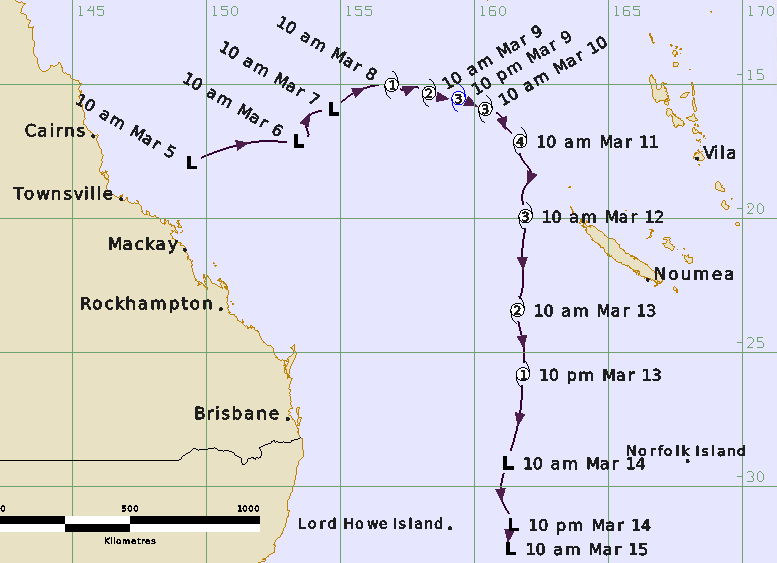
Tropical Cyclone Sandra was a Coral Sea event that reached category 3 intensity before moving to the east outside the Australian region and later affected Lord Howe Island as a sub-tropical low.
A tropical low was identified on 5 March east of Townsville. The low tracked to the east north-east over following days away from the coast as a broad circulation having strong east southeasterly flow to the south and a moderate monsoonal flow to the north. Deep convection remained largely disorganised, however winds increased to gale-force southwest of the centre late on 7 March. The system reached tropical cyclone intensity overnight from 7 to 8 March over the northeastern Coral Sea. Sandra then tracked to the east and intensified further reaching category 3 intensity on 9 March before crossing 90°E out of the Australian region.
Sandra peaked at category 4 system then turned to the south and transitioned into a sub-tropical low. Sandra passed within 220 km east of Lord Howe Island late on 14 March. Lord Howe Is (Windy Point) recorded gales for 15 hours and a maximum gust of 147 km/h. This caused significant vegetation damage but only minor structural damage.
Track and Intensity