


Burdekin region
Overview: 2013–14
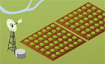
The Burdekin River is one of Australia's largest rivers and is a large source of sediment and fresh water to the Great Barrier Reef lagoon. The Burdekin Falls Dam was constructed along the Burdekin River to support irrigated agriculture and possible future hydroelectric generation in the region. The lower Burdekin River area is northern Australia's largest irrigation area covering approximately 800 km2 and is one of Australia's most important sugar producing regions.
Rainfall across the region was 485 mm in 2013–14, which was well below the long-term average. These rainfall conditions contributed to very low streamflows in the primary river systems (Burdekin, Bowen-Broken, Cape and Suttor-Belyando) within the region. Despite these low river flows, closing net water assets in the Burdekin region was 2,003,189 ML, only slightly lower than the opening water assets of 2,003,839 ML. For more information on the region's water assets refer to Water accounting statements.
The key water account information for the Burdekin region during the 2013–14 year is presented in the following table. Information on the uncertainty associated with the volumes presented in the table is provided in the relevant sections of the account.
Contextual information
 | 2013–14 | Long–term average |
| Rainfall: 485 mm | Rainfall: 656 mm | |
| For more detail on the Burdekin climate refer to Climate and water overview. | ||
 | Bowen River | Burdekin River | Cape River | Suttor–Belyando River |
| well below mean annual flow | below mean annual flow | below mean annual flow | well below mean annual flow | |
| For more detail on streamflow in the Burdekin region refer to Climate and water overview. | ||||
Water accounting statements
 | 2013–14 | |
| Total water assets as at 30 June (ML) | 2,003,189 | |
| Total water liabilities as at 30 June (ML) | 0 | |
| Closing net water assets (ML) | 2,003,189 | |
| Change in net water assets (ML) | (650) | |
| For more detail on water assets and water liabilities refer to Water accounting statements. | ||
Notes: supporting information
 | 30 June 2014 | 30 June 2013 | |||
| Total capacity | Volume | % of capacity | Volume | % of capacity | |
| 2,025,831 ML | 2,003,189 ML | 99% | 2,003,839 ML | 99% | |
| For more detail on surface water storage in the Burdekin region refer to Surface water. | |||||
 | Total water abstracted | |
| 2013–14 | Comment | |
| Surface water: 967,425 ML | Most water abstraction is for irrigation scheme supply. | |
| Groundwater: 45,072 ML | ||
| For more detail on water abstraction in the Burdekin region refer to Surface water and Groundwater. | ||
 | Total water supplied | |
| 2013–14 | Comment | |
| 5,785 ML | Most town water supply is from groundwater. | |
| For more detail on urban water supply in the Burdekin region refer to Surface water and Groundwater. | ||
 | Total water supplied | |
| 2013–14 | Comment | |
| 542,890 ML | All irrigation scheme supply is from surface water; the groundwater contribution could not be quantified. | |
| For more detail on the irrigation scheme in the Burdekin region refer to Surface water. | ||