Ord
Climate overview
Rainfall
Rainfall across the Ord region was very much above average for the 2013–14 year (Figure C1). The total area-averaged rainfall over the Ord region during the year was 1,042 mm, which is well above the long-term area-averaged rainfall of 680 mm (based on the 1900–2014 period).
These conditions represent an increase in rainfall compared to the 2012–13 year when rainfall was below average (see the 2013 Account). Consequently, flows in the major rivers within the region were much higher than the previous year (see Water overview).
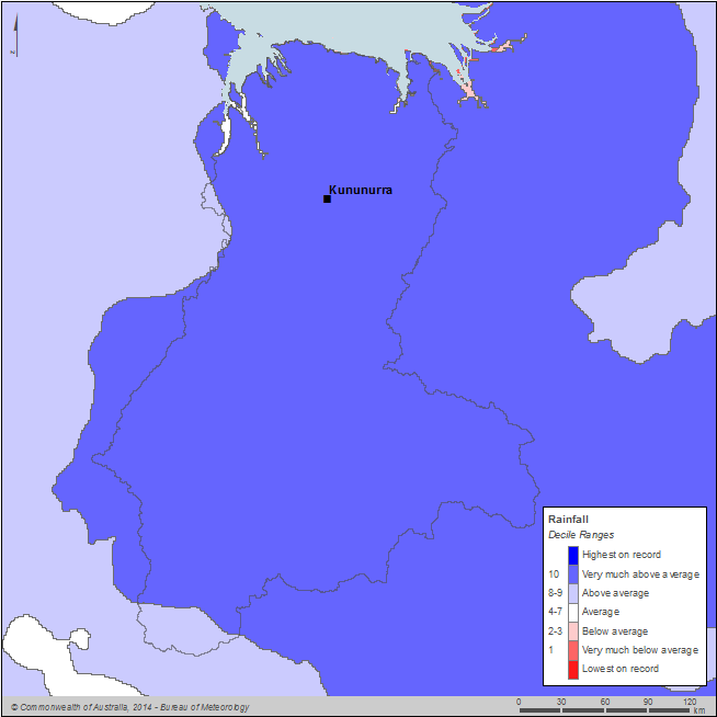
Figure C1 Annual rainfall deciles for the Ord region during the 2013–14 year
Annual rainfall ranged from more than 1,200 mm in the coastal north of the region, including Kununurra, to less than 900 mm in the southern part of the region (Figure C2).
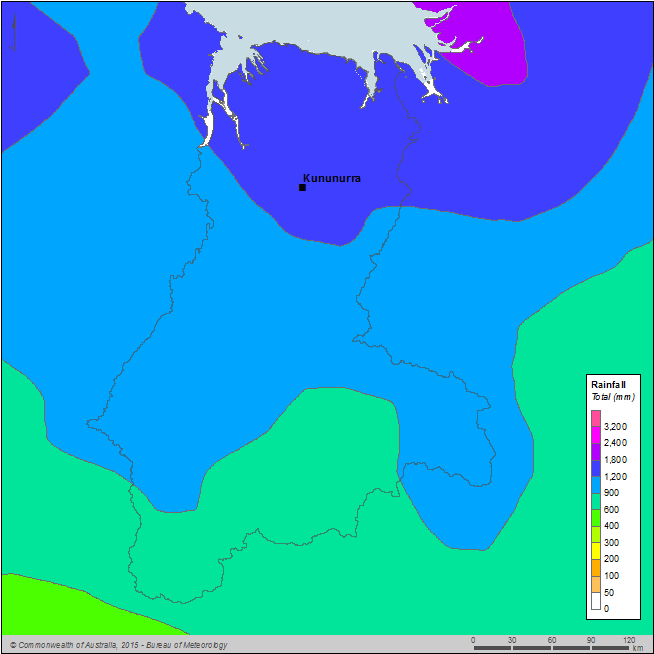
Figure C2 Total annual rainfall for the Ord region during the 2013–14 year
Generally average to above average rainfall was experienced across much of Australia's northwest region during the 2013–14 year. There were no strong influences from large-scale climate drivers during the year. Conditions in the Pacific Ocean were neutral and a short-lived negative Indian Ocean Dipole event, which developed towards the end of last year, decayed at the start of the 2013–14 year. The El Niño-Southern Oscillation was also neutral for most of the year.
The Ord region experienced well above-average rainfall for most of the wet season (October–April), particularly during the typically wettest months of January–February (Figure C3). A large rainfall event during 6–8 February 2014 contributed to the very high monthly rainfall total for February. Most of the rainfall during this event occurred in the lower Ord region. Around Kununurra, more than 365 mm of rainfall was observed during the 72-hour period, which is equivalent to a greater than 1 in 50 year rainfall event. This event is described in more detail in the Water overview.
The above average rainfall during the wet season contributed to well above average flows in the major rivers within the region (see Water overview), particularly during January–February.
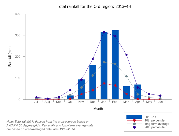
Figure C3 Total monthly rainfall for the Ord region during the 2013–14 year compared with the long-term average and percentiles for the region
Evapotranspiration
Potential evapotranspiration across the Ord region was generally average for the 2013–14 year (Figure C4).
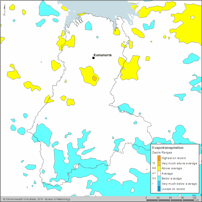
Figure C4 Annual evapotranspiration deciles for the Ord region during the 2013–14 year
The potential evapotranspiration estimate was produced by the Australian Water Resources Assessment system landscape model (AWRA-L) version 3.0 (Van Dijk 2010). The AWRA-L model uses a modified version of the Penman–Monteith method to produce the potential evaporation. Daily AWRA-L potential evaporation grids were produced based on daily gridded climate data that were available on a 0.050 (approximately 5 km) national grid.
The total area-averaged potential evapotranspiration over the Ord region during the 2013–14 year was 1,485 mm, which is similar to the long-term area-averaged potential evapotranspiration of 1,489 mm (based on the 1970–2014 period). Potential evapotranspiration was highest in the north along the coast and relatively uniform across the remainder of the region (Figure C5).
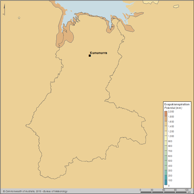
Figure C5 Total annual potential evapotranspiration for the Ord region during the 2013–14 year
Temperature
During the 2013–14 year, most of the Ord region experienced mean temperatures above the long-term average (based on the 1911–2014 period); mean temperatures in the southwest of the region were average (Figure C6).
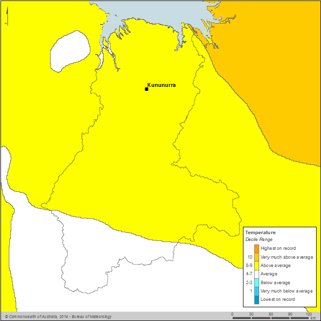
Figure C6 Annual mean temperature deciles for the Ord region during the 2013–14 year
Mean temperatures across the Ord region ranged from more than 24°C in the southern parts of the region to more than 27°C in the central and northern parts of the region (Figure C7).
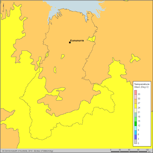
Figure C7 Mean temperature for the Ord region during the 2013–14 year
Except for the middle of the wet season period, monthly mean temperatures for the Ord region were above the long-term average for most of the 2013–14 year (Figure C8). Temperatures during the middle of the wet season (December–February) were well below average, particularly February, which is consistent with the effect of increased cloud cover as a result of above average rainfall observed during this period.
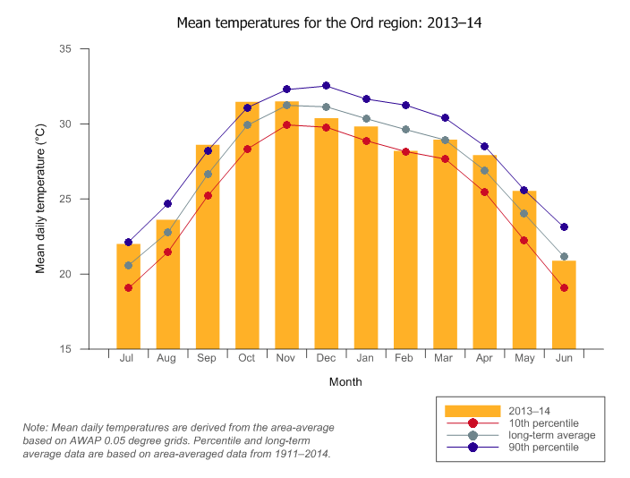
Figure C8 Monthly mean daily temperature for the Ord region during the 2013–14 year compared with the long-term average and percentiles for the region


