Tropical Cyclone Ellie

1 February 2009

Summary

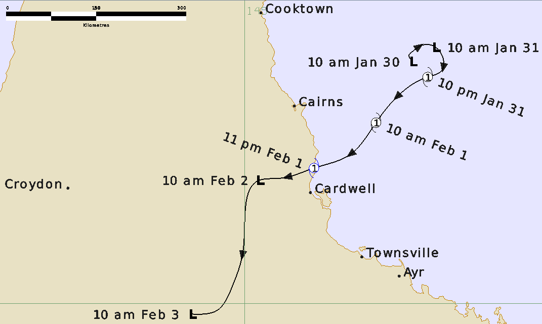
A low pressure system developed on the monsoon trough off the north tropical coast of Qld north-east of Cairns during the day on Thursday January 29th. This monsoon low moved southwards during Friday January 30th while deepening. The low hovered to the east north-east of Cairns during Saturday January 31st and developed into Category 1 Tropical Cyclone Ellie very early on Sunday February 1st as upper atmospheric conditions became favourable.

Observations from the reef platforms in the area indicated mean winds of at least 40 knots occurred with Ellie. Ellie moved in a slow south-west direction during the morning with movement shifting to the west from the late afternoon onwards. The system crossed the coast north of Cardwell near Clump Point close to midnight and then rapidly weakened into a rain depression. As Ellie crossed the coast, a Queensland Environmental Protection Authority barometer at Clump Point, near Mission Beach, indicated a minimum pressure of 991 hpa

The depression then continued in a general west to south-west direction over the following few days. Heavy to flood rains developed about the coast and ranges between Cardwell and Bowen during Sunday. This heavy rainfall continued into and during Monday focused mainly on the Herbert River catchment. Rainfalls in excess of 1 metre over 2 to 3 days occurred in this catchment area.

Coastal Crossing Details

Crossing time:
Around 23:55 EST 1 February 2009
Crossing location:
Near Mission Beach
Category when crossing the coast:
1

Extreme Values During Cyclone Event:

Maximum Category:
1
Maximum sustained wind speed:
75 km/h
Maximum wind gust:
100 km/h
Lowest central pressure:
990 hPa

Track and intensity


Track of Tropical Cyclone Ellie