Summary
Severe Tropical Gabrielle was a large Coral Sea tropical cyclone that passed close to Norfolk Island after it had transitioned into an intense sub-tropical system.
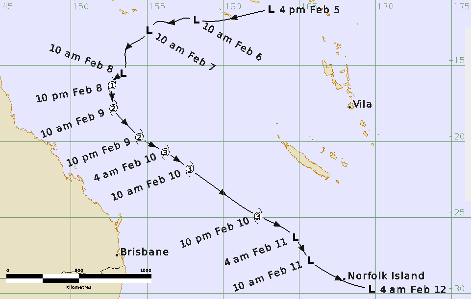
A low formed near the Solomon Islands on 5 February and moved southwest. The low formed into a tropical cyclone at 1200 UTC 8 February and continued to intensify as it turned to the south and then the southeast. Gabrielle reached a peak 10-minute mean wind intensity of 80 kn (150 km/h) at 0600 UTC 10 February. As Gabrielle accelerated to the southeast, it transitioned into a sub-tropical system before passing directly over Norfolk Island during the overnight period from 11 to 12 February. Gabrielle continued to move in a south easterly direction and impacted the north island of New Zealand (refer to Figure 1).
Although Tropical Cyclone Advices were issued for Norfolk Island indicating the potential for destructive winds, the island escaped with relatively minor wind impacts such as trees and power lines down. The cyclone had a very large gale radius, particularly as it transitioned to a sub-tropical low. This resulted in high waves that caused large boulders to be flung onto the Cascade Pier which damaged railings and the pier surface. The Norfolk Island Airport recorded a minimum pressure of 958.1 hPa, its lowest pressure on record.
For more information see the TC Gabrielle Report (docx).
Track and Intensity