Summary
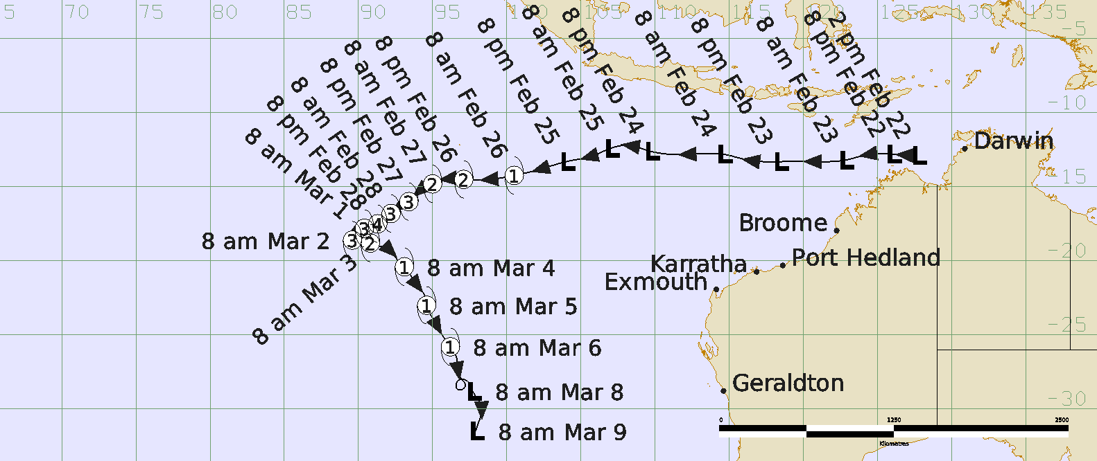
Severe Tropical Cyclone Marian was a long-lived Indian Ocean event that started near Darwin and travelled over open waters without causing any impacts to Australian communities.
A weak tropical low was first identified in the Timor Sea near the western coast of the Top End of the Northern Territory on 22 February. It quickly moved west, well to the north of Western Australia while slowly developing. It reached tropical cyclone intensity on 26 February and passed to the south of the Cocos (Keeling) Islands. While a Warning was issued for the islands, no direct impact occurred.
On 1 March, Marian started to move slowly south while gradually intensifying. Marian reached peak intensity at 90 knots (165 km/h, category 4) on 28 February near 90°E, the western boundary of the Australian area of responsibility. Marian initially weakened under reduced sea surface temperatures, as a result of its slow motion causing the mixing of cooler sub-surface waters.
Marian then turned to the southeast and gradually weakened.
By 5 March, the system encountered a high shear environment, dry air and cooler sea surface temperatures weakening the system below cyclone strength on 6 March.
There was no impact to any island or coastal communities.
For more information see the TC Marian Report (doc).
Track and Intensity