Summary
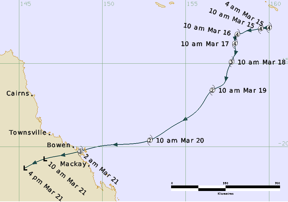
Severe Tropical Cyclone Ului was initially analysed as a tropical low situated in the Pacific Ocean to the north of Vanuatu on March 8th. The low then traversed across the northern islands of Vanuatu and into the far northeast Coral Sea before it developed into a tropical cyclone late in the day on March 12th. Ului then rapidly intensified over the next couple of days into a severe tropical cyclone as it moved in a westerly direction to the south of the Solomon Islands.
From the 15th to 17th March, Ului became a slow moving system as it gradually adopted a south to southwesterly track. Ului underwent a weakening phase as the system moved across the Coral Sea due to a combination of increased wind shear from an upper trough crossing the Tasman Sea and cool sea surface temperatures.
As Ului fell under the influence of an upper ridge on 18th March the system accelerated towards the Queensland east coast, and reintensified into a severe tropical cyclone. Severe Tropical Cyclone Ului made landfall near Airlie Beach on the Whitsunday Coast at approximately 1.30am on March 21st.
Significant wind damage was reported around the Central Coast and Whitsundays district, mainly between Airlie Beach and Mackay. Reports of damage include widespread tree damage, large areas of sugarcane destroyed and localised structural damage, particularly to roofs. About 50,000 homes lost power following the passage of the system. Many boats were also damaged or destroyed due to large seas and swell created by Ului, particularly around Shute Harbour near Airlie Beach.
Severe Tropical Cyclone Ului was the third tropical cyclone in the Queensland area of responsibility during the 2009/10 season.