This line item refers to the volume of surface water that flowed into the Canberra region from the upstream Murrumbidgee River. This data is based on modelling provided by the Bureau of Meteorology.
124,326 ML of connected surface water flow from outside region.
ACT Government Department of Environment, Climate Change, Energy and Water: Environment Protection, Water Resources data archive.
Australian Government Department of Environment, Climate Change, Energy and Water.
The connected surface water flow from the upstream entity was obtained by averaging the annual streamflow observed at gauging stations 410050 (Murrumbidgee River at Billiligra) and 410761 (Murrumbidgee River at Lobbs Hole). Justification for this is that station 410050 is upstream of the Canberra region and station 410761 is within the region. Therefore, an average provides the ability to even out the difference that may have occurred due to distance from the boundary. The location of the gauging stations is shown in the figure below.
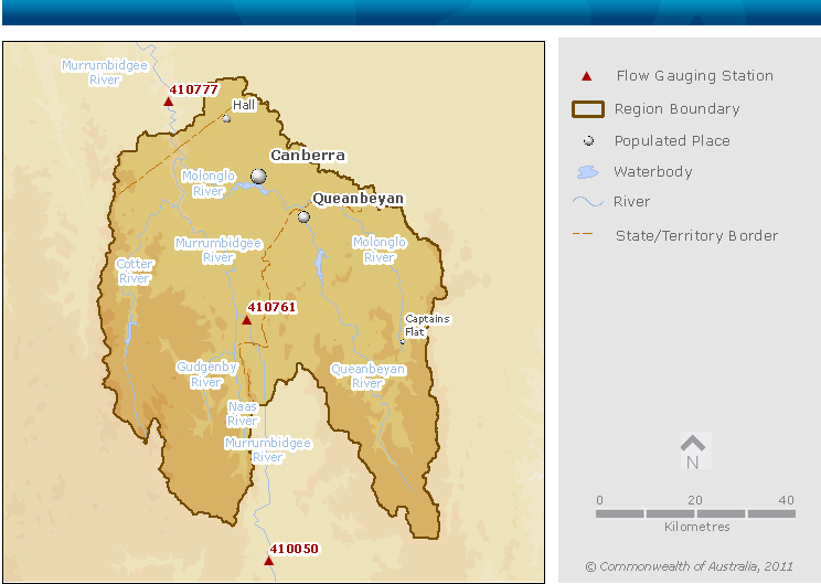
Map showing the location of stream gauging stations used to calculate inflow and outflow for the Canberra region
Ungraded.
National Water Account 2010
Related links
Water links
