Daly
Climate overview
Rainfall
Rainfall across most of the Daly region was close to average for the 2012–13 year (Figure C1). The total area-averaged rainfall over the Daly region during the 2012–13 year was 1,068 mm, which is slightly above the long-term area-averaged rainfall of 1,034 mm (for the period 1900–2013). The 2012–13 conditions represent a slight decrease in rainfall when compared to the 2011–12 year total of 1,127 mm (see 2012 Account).
A small area near Katherine township recorded rainfall very much above the long-term average while rainfall in the northeast of the region was below long-term average.
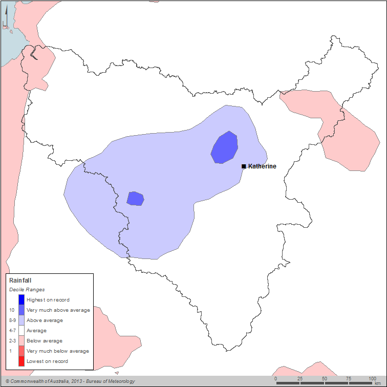
Figure C1 Map of annual rainfall deciles for the Daly region during the 2012–13 year
Annual rainfall ranged from more than 1,200 mm in central and northwestern parts of the region to less than 700 mm in the south (Figure C2).
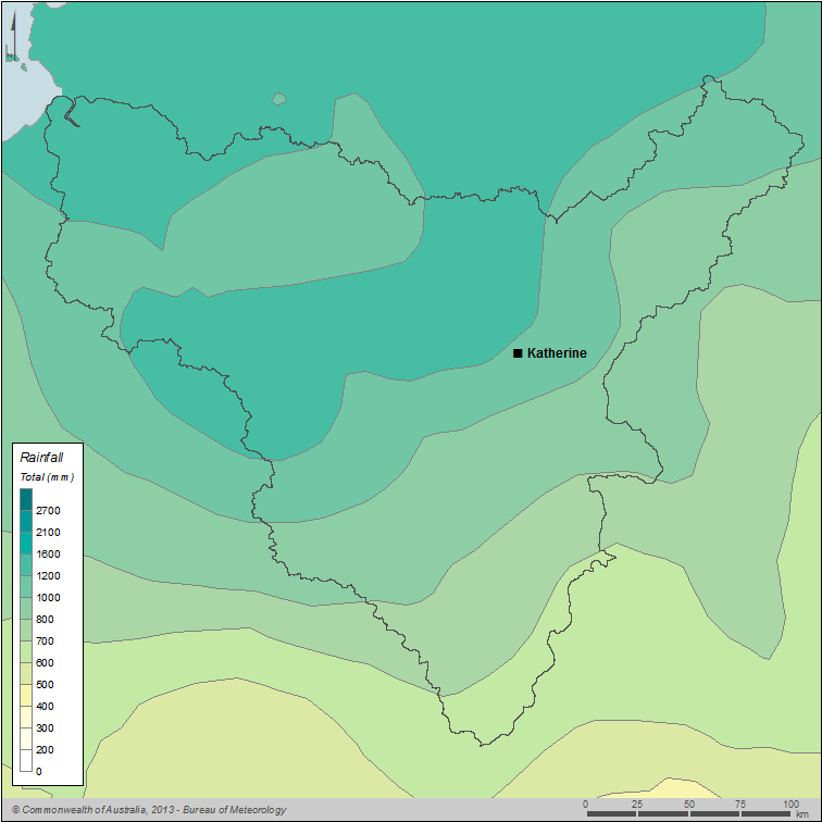
Figure C2 Map of total annual rainfall for the Daly region during the 2012–13 year
Generally below average rainfall was experienced across much of Australia during the 2012-13 year. There were no strong influences from large-scale climate drivers over the 2012–13 year. Conditions in the Pacific Ocean were neutral and a negative Indian Ocean Dipole event developed during the dry season of 2013 (at the end of the reporting period).
The area-averaged monthly rainfall varied over the 2012–13 year (Figure C3). March 2013 was the wettest month of the reporting period in the Daly region, recording almost double the long-term area-average. In contrast, the early to middle months of the wet season (December–February) were all drier than usual for the Daly region.
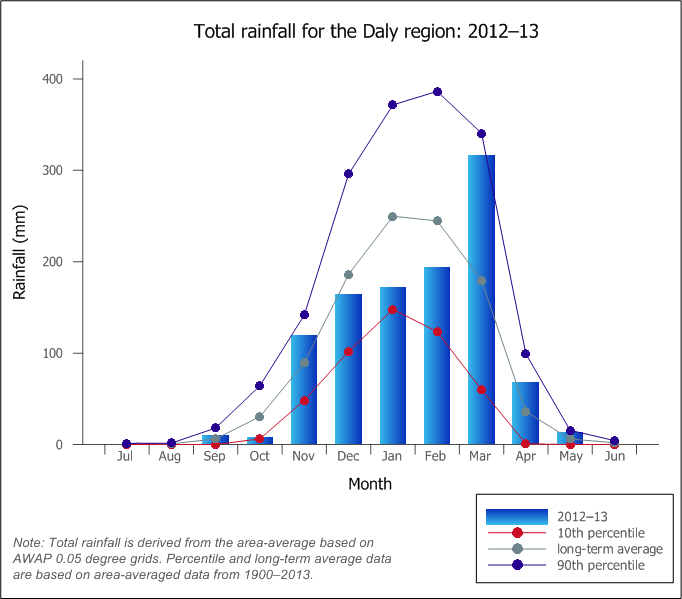
Figure C3 Graph of total monthly rainfall for the Daly region during the 2012–13 year compared with the long-term average and percentiles for the region
Evapotranspiration
Evapotranspiration across the region was above average to very much above average for the 2012–13 year (Figure C4). The above average evapotranspiration reflects the above average rainfall experienced across the region, particularly during the early part of the wet season, November–December (see Rainfall). As a result of this rainfall, more water was available for evaporation, particularly given the above-average rainfall in October–December corresponded with the hottest part of the year (see Temperature).
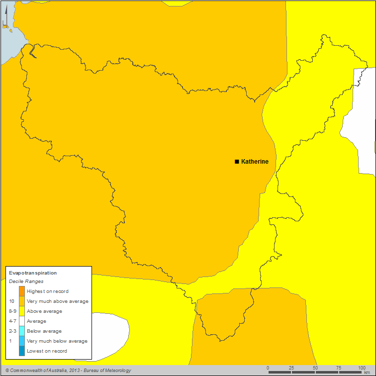
Figure C4 Map of annual evapotranspiration deciles for the Daly region during the 2012–13 year
The total area-averaged evapotranspiration over the Daly region during the 2012–13 year was 927 mm, which is above the long-term annual mean of 809 mm (for the period 1900–2013). Evapotranspiration ranged from 600 mm in the south to 1,200 mm in the north of the region (Figure C5).
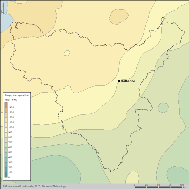
Figure C5 Map of evapotranspiration for the Daly region during the 2012–13 year
Temperature
The Daly region generally experienced mean temperatures very much above the long-term average during the 2012–13 year (Figure C6). The long-term period is calculated from the period 1911–2013.
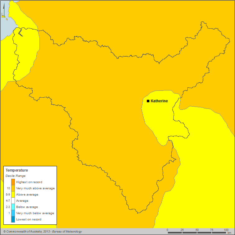
Figure C6 Map of annual mean temperature deciles for the Daly region during the 2012–13 year
The entire Daly region experienced annual mean temperatures exceeding 26 °C during the reporting period (Figure 16).
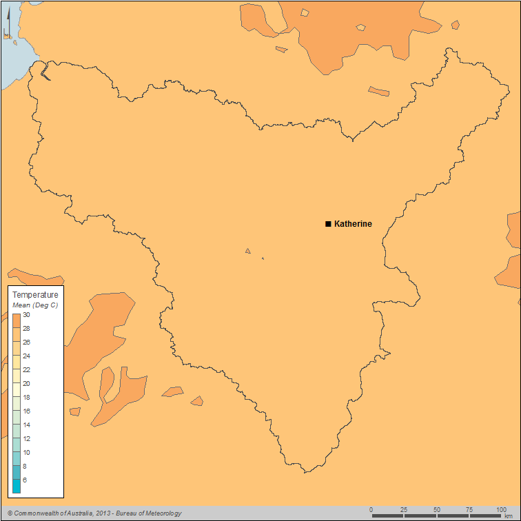
Figure C7 Map of annual mean temperature for the Daly region during the 2012–13 year
Monthly mean temperatures for the Daly region were above the long-term average during the 2012–13 year, except for July and August 2012 (Figure C8). Mean temperatures in December 2012, as well as January, May and June 2013, were all above the 90th percentile. January 2013 was the second-warmest January on record for the Daly region.
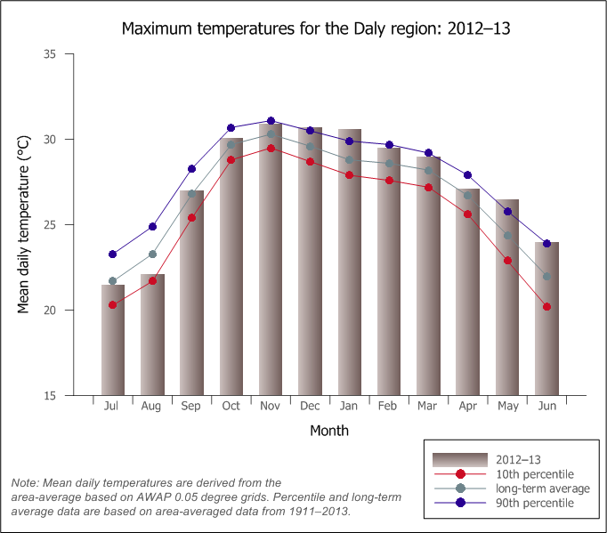
Figure C8 Graph of monthly mean daily temperature for the Daly region during the 2012–13 year compared with the long-term average and percentiles for the region


