Daly
10.1 Groundwater inflow from outside region
Supporting information
a. Groundwater model
The Department of Land Resource Management (The Department) use the Finite Element Subsurface Flow system (FEFLOW) to estimate the natural water movement to and from the groundwater store within the Daly region.
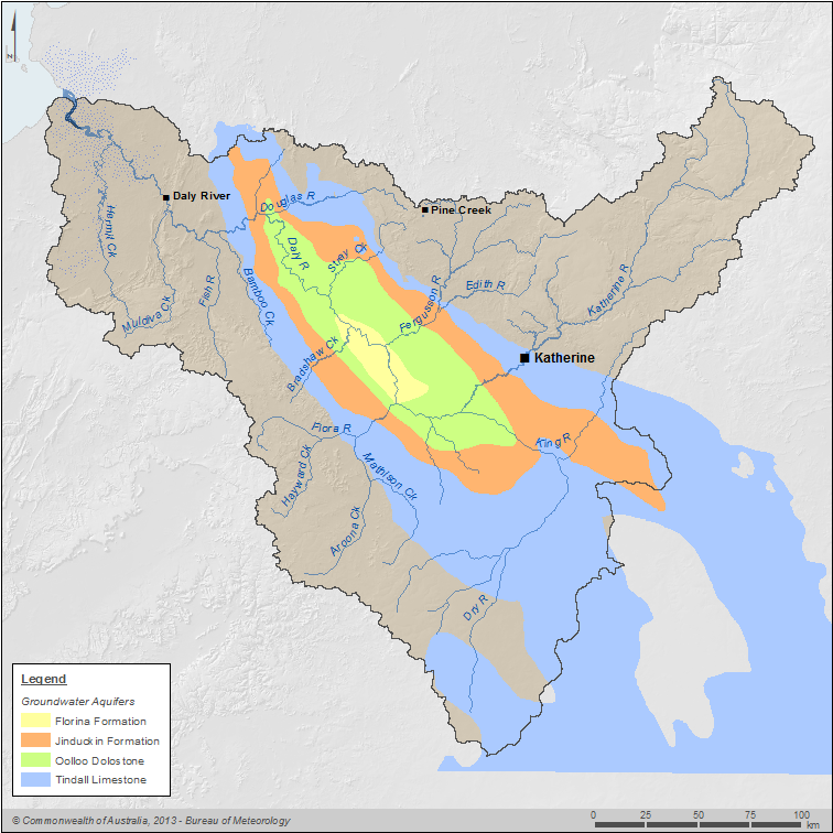
FEFLOW estimates groundwater movement for the entire extent of the Oolloo aquifer and the Tindall aquifer, which extends beyond the Daly region boundary as shown in the figure below. The volumes reported in this account refer to the natural water movement that occurs within these aquifers within the Daly region boundary.

Map of the groundwater model area relative to the Daly region boundary
The Oolloo and Tindall aquifers are karstic and were modelled as an equivalent porous media with relatively limited storage. The groundwater model was calibrated using regional aquifer parameters to reproduce the observed groundwater levels and discharge to the rivers, as outlined in NRETAS 2010.
b. Supporting information
The volume recognised in the water accounting statements of 10,000 ML represents the total volume of groundwater inflow from outside the Daly region boundary during the 2012–13 year.
Quantification approach
Data source
FEFLOW groundwater model.
Provided by
The Department of Land Resource Management.
Method
The groundwater model derives the lateral flux within the Daly region by defining the appropriate water balance zones and calculating the volume of water flowing across each boundary on an annual basis.
Detailed information on the model calibrations are provided in NRETAS 2010.
Assumptions, limitations, caveats and approximations
Uncertainty information
The uncertainty is unquantified.


