


Canberra region
Overview: 2013–14
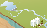
The Canberra region is located in the Murrumbidgee River catchment in the headwaters of the Murray–Darling Basin. It includes the Australian Capital Territory and some catchments in New South Wales that contribute to its water supply. The Canberra city is the largest urban centre within the Murray–Darling Basin. The Murrumbidgee River is the main waterway which runs through the region, and its tributaries that lie within the region include the Cotter, Gudgenby, Molonglo, and Queanbeyan rivers.
Water supply in the region is primarily sourced from storages and rivers. The major storages are the Bendora, Corin, Cotter, and Googong reservoirs. The recent enlargement of the Cotter Reservoir increased its total capacity almost 20-fold, from 3,856 ML to 79,374 ML. This increase will assist in the management of frequent, longer, and more severe droughts without the need to implement high-level water restrictions for extended periods. As a result, total surface water storage capacity in the Canberra region has increased from 207,380 ML to 282,898 ML. The enlarged Cotter Reservoir began impounding water on 1 March 2013 and it is likely that the reservoir will reach full capacity in early 2015.
Rainfall across the Canberra region was marginally above average for the 2013–14 year and approximately 15% more than the previous year. These rainfall conditions, combined with generally average soil moisture conditions across the region, contributed to increased inflows into surface water storages. The volume of water held in storages increased during the 2013–14 year by 38,158 ML. Closing net water assets in the Canberra region were 259,090 ML, compared to 216,876 ML at the end of the 2012–13 year. For more information on the region's water assets refer to Water accounting statements.
The key water account information for the Canberra region during the 2013–14 year is presented in the following table. Information on the uncertainty associated with the volumes presented in the table is provided in the relevant sections of the account.
Contextual information
 | 2013–14 | 2012–13 | Long–term average |
Rainfall: 805 mm |
Rainfall: 692 mm |
Rainfall: 794 mm | |
| For more detail on the Canberra climate refer to Climate overview. | |||
 | Molonglo River | Cotter River | Queanbeyan River |
| below mean annual flow | below mean annual flow | above mean annual flow | |
| For more detail on streamflow in the Canberra region refer to Water overview. | |||
Water accounting statements
 | 2013–14 | 2012–13 | |
| Total water assets (as at 30 June) | 259,090 | 216,876 | |
| Total water liabilities (as at 30 June) | – | – | |
| Change in net water assets | 42,214 | (24,791) | |
| Closing net water assets | 259,090 | 216,876 | |
| For more detail on water assets and water liabilities refer to Water accounting statements. | |||
Notes: supporting information
 | 30 June 2014 | 30 June 2013 | |||
| Total capacity | Volume | % of capacity | Volume | % of capacity | |
| 282,898 ML | 219,448 ML | 77.6% | 181,290 ML | 64.1% | |
| For more detail on surface water storage in the Canberra region refer to Surface water. | |||||
 | Total water abstracted | ||
| 2013–14 | 2012–13 | Recent activity | |
| Surface water: 49,888 ML | Surface water: 49,552 ML | Water abstraction relatively unchanged. | |
| Groundwater: 894 ML | Groundwater: 1,020 ML | ||
For more detail on water abstraction in the Canberra region refer to Surface water and Groundwater. | |||
 | Total water supplied | ||
| 2013–14 | 2012–13 | Recent activity | |
| 48,695 ML | 47,838 ML | Surface water diversion for urban supply relatively unchanged. | |
| For more detail on the urban water system in the Canberra region refer to Urban water system. | |||